MyTopo
Pickwick Minnesota US Topo Map
Couldn't load pickup availability
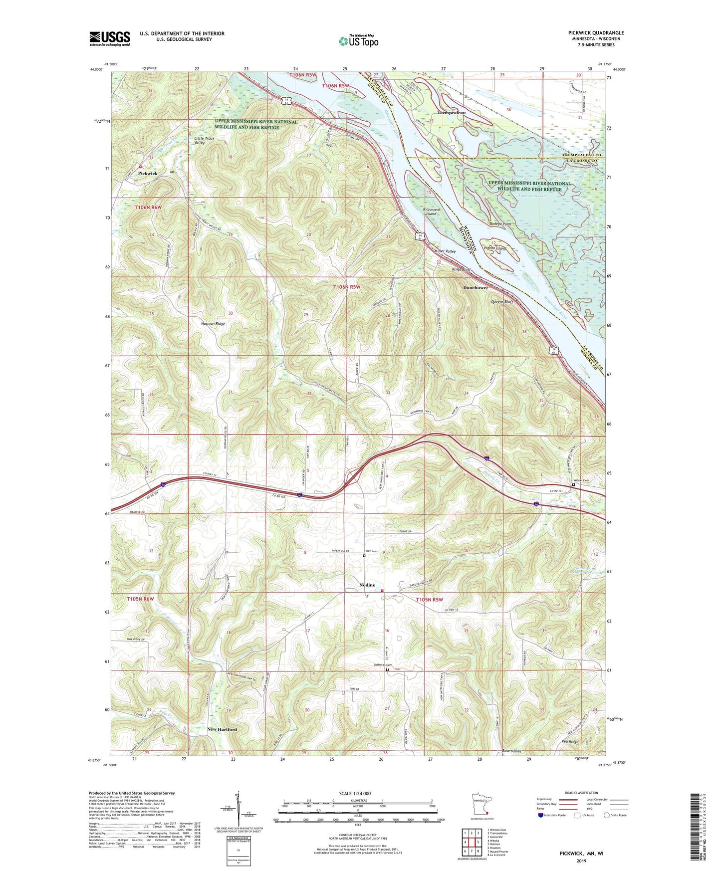
2019 topographic map quadrangle Pickwick in the states of Minnesota, Wisconsin. Scale: 1:24000. Based on the newly updated USGS 7.5' US Topo map series, this map is in the following counties: Winona, La Crosse, Trempealeau. The map contains contour data, water features, and other items you are used to seeing on USGS maps, but also has updated roads and other features. This is the next generation of topographic maps. Printed on high-quality waterproof paper with UV fade-resistant inks.
Quads adjacent to this one:
West: Witoka
Northwest: Winona East
North: Trempealeau
Northeast: Galesville
East: Holmen
Southeast: La Crescent
South: Mound Prairie
Southwest: Houston
Contains the following named places: Big Marsh, Big Trout Creek, Bodega Point, Donehower, Great River Bluffs Historical Marker, Great River Bluffs State Park, Hiler Cemetery, Husman Ridge, Kings Bluff, Little Trout Detention Number 1 Dam, Little Trout Detention Number 2 Dam, Little Trout Valley, Lock and Dam 6, Lock and Dam Number 6, Long Lake, Long Lake Canoe Trail, Lutheran Cemetery, Lutherhaven Camp, Miller Valley, Mud Lake, New Hartford, New Hartford Post Office, Nodine, Nodine Post Office, Nodine Volunteer Fire Department, Pickwick, Pickwick Baptist Church, Pickwick Census Designated Place, Pickwick Dam, Pickwick Fire and Rescue Department, Pickwick Post Office, Pigeon Island, Queens Bluff, Richmond Island, Round Lake, Saint Luke Lutheran Church, Second Lake, Southwind Orchards, Spring Slough, Tank Creek, Third Lake, Township of New Hartford, Township of Richmond, Trempealeau Lakes State Public Hunting Grounds, Tremplo Fishing Float, Twin Bluffs Scenic Overlook, Victor Gunderson-Marmsoler Detention Dam, Wilson Cemetery, ZIP Code: 55925