MyTopo
Pine River Minnesota US Topo Map
Couldn't load pickup availability
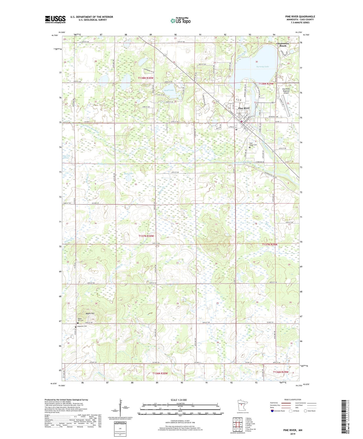
2019 topographic map quadrangle Pine River in the state of Minnesota. Scale: 1:24000. Based on the newly updated USGS 7.5' US Topo map series, this map is in the following counties: Cass. The map contains contour data, water features, and other items you are used to seeing on USGS maps, but also has updated roads and other features. This is the next generation of topographic maps. Printed on high-quality waterproof paper with UV fade-resistant inks.
Quads adjacent to this one:
West: Bungo Creek
Northwest: Backus
North: Mildred
Northeast: Lake Ada
East: Jenkins
Southeast: Nisswa
South: Pine River SW
Southwest: Graff
Contains the following named places: Anderson Cemetery, Apostolic Church, Behler Creek, Chickamaw Beach, City of Chickamaw Beach, City of Pine River, First Lutheran Church, Grace United Methodist Church, Hoblin Creek, Maple Hill, Maple Hill Cemetery, Maple Hill Church, Mud Lake, Norway Lake, Norway Lake Dam, Our Lady of Lourdes Catholic Church, Pequot Lakes Baptist Church, Pine Ridge Cemetery, Pine River, Pine River - Backus High School, Pine River Baptist Church, Pine River Country Club, Pine River Elementary School, Pine River Family Clinic, Pine River Library, Pine River Police Department, Pine River Post Office, Pine River Regional Airport, Pine River United Methodist Church, Pine River Volunteer Fire Department, Sand Lake, South Fork Pine River, Tamarack Lake, Township of Walden, Township of Wilson, Whispering Pines Good Samaritan Center, Wilson Creek, ZIP Code: 56474