MyTopo
Randolph Minnesota US Topo Map
Couldn't load pickup availability
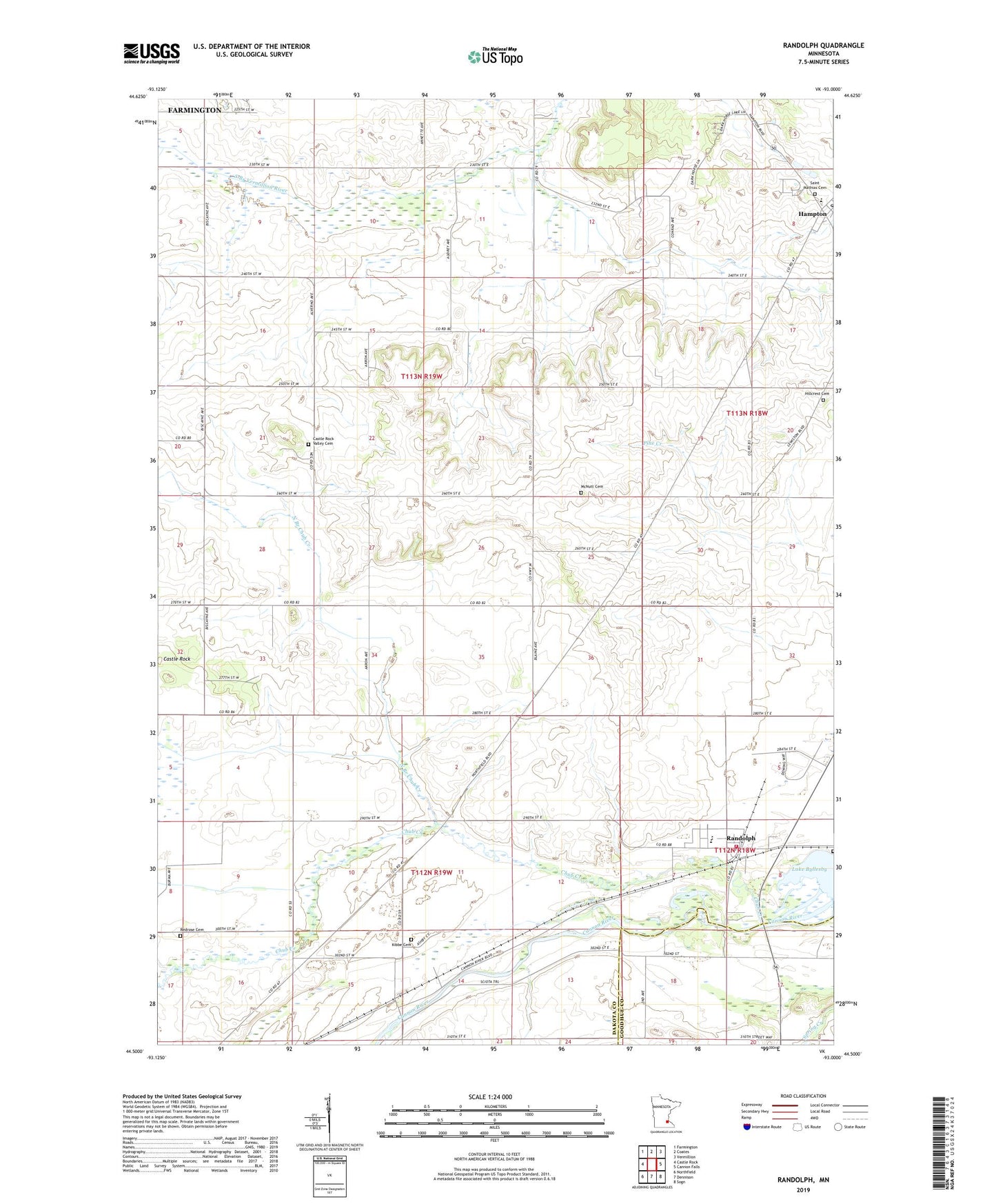
2019 topographic map quadrangle Randolph in the state of Minnesota. Scale: 1:24000. Based on the newly updated USGS 7.5' US Topo map series, this map is in the following counties: Dakota, Goodhue. The map contains contour data, water features, and other items you are used to seeing on USGS maps, but also has updated roads and other features. This is the next generation of topographic maps. Printed on high-quality waterproof paper with UV fade-resistant inks.
Quads adjacent to this one:
West: Castle Rock
Northwest: Farmington
North: Coates
Northeast: Vermillion
East: Cannon Falls
Southeast: Sogn
South: Dennison
Southwest: Northfield
Contains the following named places: Castle Rock, Castle Rock Valley Cemetery, Chub Creek, City of Hampton, City of Randolph, Hampton, Hillcrest Cemetery, Kibbe Cemetery, Lakeside Cemetery, Lewiston Post Office, Lewiston Railroad Station, Lucht Field, McNutt Cemetery, North Branch Chub Creek, Randolph, Randolph - Hampton Fire Department Station 1 Headquarters, Randolph Baptist Church, Randolph City Hall, Randolph Elementary School, Randolph High School, Randolph Post Office, Randolph Public School, Randolph United Methodist Church, Redrose Cemetery, Saint Marks Lutheran Church, Saint Mathias Catholic Church, Saint Mathias Cemetery, Saint Mathias School, Township of Castle Rock, Township of Sciota, ZIP Code: 55065