MyTopo
Reno Minnesota US Topo Map
Couldn't load pickup availability
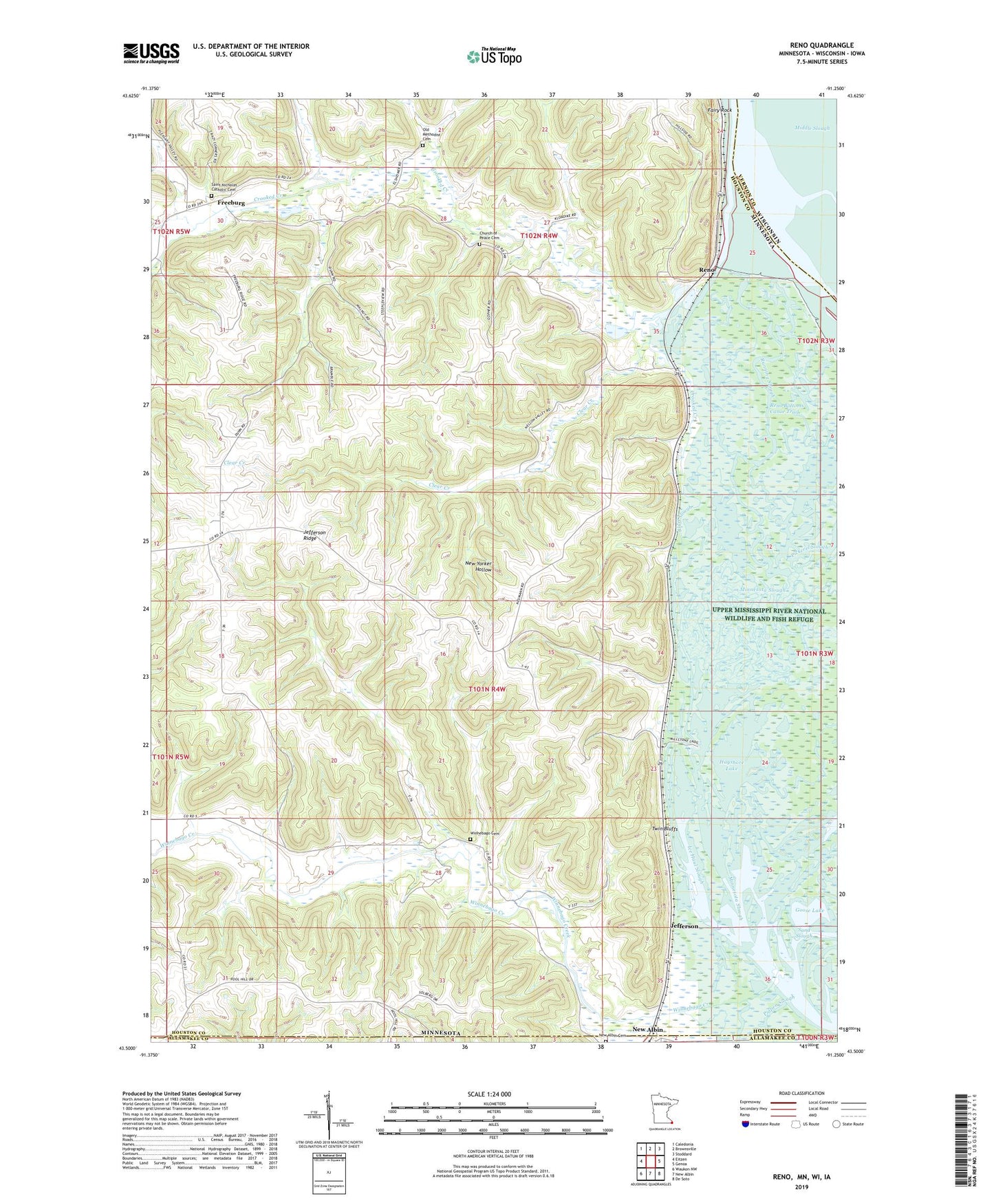
2019 topographic map quadrangle Reno in the states of Minnesota, Wisconsin, Iowa. Scale: 1:24000. Based on the newly updated USGS 7.5' US Topo map series, this map is in the following counties: Houston, Vernon, Allamakee. The map contains contour data, water features, and other items you are used to seeing on USGS maps, but also has updated roads and other features. This is the next generation of topographic maps. Printed on high-quality waterproof paper with UV fade-resistant inks.
Quads adjacent to this one:
West: Eitzen
Northwest: Caledonia
North: Brownsville
Northeast: Stoddard
East: Genoa
Southeast: De Soto
South: New Albin
Southwest: Waukon NW
Contains the following named places: Bluff Slough, Church of Peace Cemetery, Clear Creek, Crooked Creek, Dark Slough, Fairy Rock, Freeburg, Freeburg Post Office, Goose Lake, Hayshore Lake, Ice Haul Slough, Jefferson, Jefferson Ridge, Middle Slough, Millstone Landing Public Access, Mud Lake, New Albin Cemetery, Old Methodist Cemetery, Pickerel Slough, Pigpen Slough, Reno, Reno Bottoms Canoe Trail, Reno Post Office, Richards Group Structure Dam, Running Slough, Saint Nicholas Catholic Cemetery, Sand Slough, Township of Crooked Creek, Township of Jefferson, Twin Bluffs, Visgers Landing Public Access, Winnebago Cemetery, Winnebago Creek, ZIP Code: 55919