
MyTopo
Richwood Minnesota US Topo Map
Couldn't load pickup availability
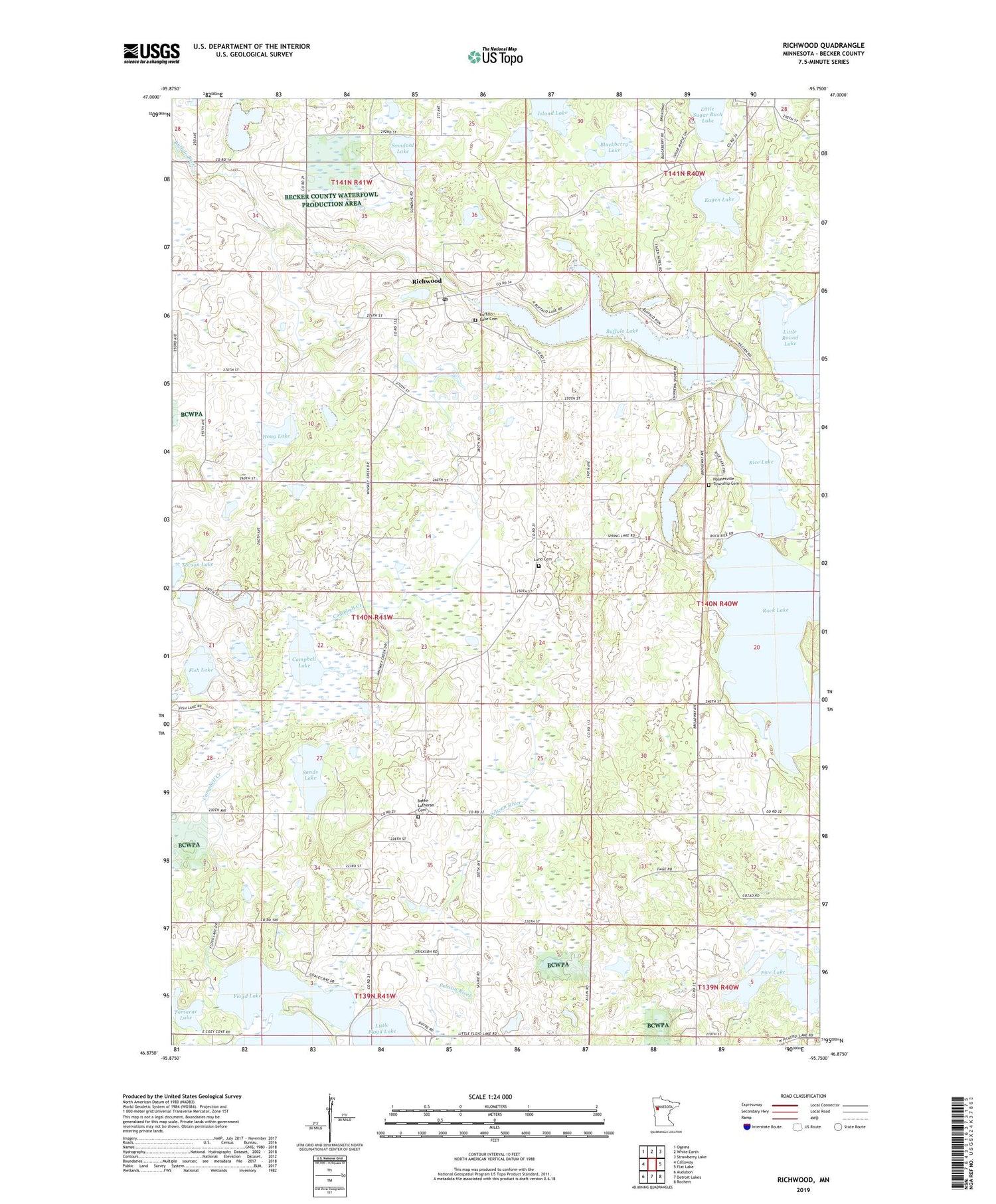
2019 topographic map quadrangle Richwood in the state of Minnesota. Scale: 1:24000. Based on the newly updated USGS 7.5' US Topo map series, this map is in the following counties: Becker. The map contains contour data, water features, and other items you are used to seeing on USGS maps, but also has updated roads and other features. This is the next generation of topographic maps. Printed on high-quality waterproof paper with UV fade-resistant inks.
Quads adjacent to this one:
West: Callaway
Northwest: Ogema
North: White Earth
Northeast: Strawberry Lake
East: Flat Lake
Southeast: Rochert
South: Detroit Lakes
Southwest: Audubon
Contains the following named places: Albert Lake, Albert Lake Dam, Bakke Lutheran Cemetery, Bakke Lutheran Church, Bakke School, Blackberry Lake, Buffalo Lake, Buffalo Lake Campground, Buffalo Lake Cemetery, Buffalo Lake Dam, Campbell Creek, Campbell Lake, Detroit Lakes City Park, Eagen Lake, Fish Lake, Five Lake, Holmesville Church, Holmesville Township Cemetery, Houg Lake, Little Floyd Lake, Little Floyd Lake Dam, Little Floyd School, Loon Lake, Lund Cemetery, Lund Church, Northern Lights Tabernacle Church, Pelican Valley School, Rice Lake, Richwood, Richwood Post Office, Richwood Post Office - CPO, Rock Lake, Sands Lake, School Number 87, Somdahl Lake, Spring Lake, Tamarac Lake, Tovson Lake, Township of Richwood, ZIP Code: 56577


