MyTopo
Snider Lake Minnesota US Topo Map
Couldn't load pickup availability
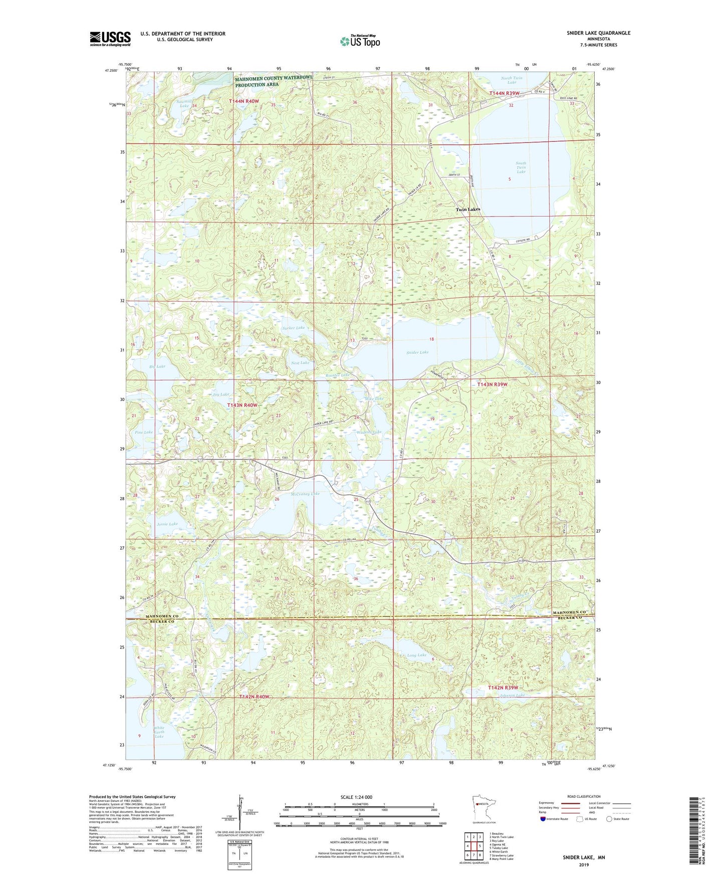
2019 topographic map quadrangle Snider Lake in the state of Minnesota. Scale: 1:24000. Based on the newly updated USGS 7.5' US Topo map series, this map is in the following counties: Mahnomen, Becker. The map contains contour data, water features, and other items you are used to seeing on USGS maps, but also has updated roads and other features. This is the next generation of topographic maps. Printed on high-quality waterproof paper with UV fade-resistant inks.
Quads adjacent to this one:
West: Ogema NE
Northwest: Beaulieu
North: North Twin Lake
Northeast: Roy Lake
East: Tulaby Lake
Southeast: Many Point Lake
South: Strawberry Lake
Southwest: White Earth
Contains the following named places: Big Lake, Crooked Lake, Egg Lake, Gable Lake, Gull Creek, Gull Lake, Jay Lake, Jessie Lake, Johnson Lake, Little Elbow Creek, Long Lake, McCraney Lake, McCraney Lake Dam, Mike Lake, Nest Lake, Pine Lake, Rooster Lake, Sawmill Lake, Snider Lake, South Twin Lake, Sucker Lake, Township of Oakland, Tulaby Creek, Tulaby Lookout Tower, Twin Lakes Census Designated Place, Wadena Lake, Wayside Park, White Earth Reservation, ZIP Code: 56589