MyTopo
Sunburg Minnesota US Topo Map
Couldn't load pickup availability
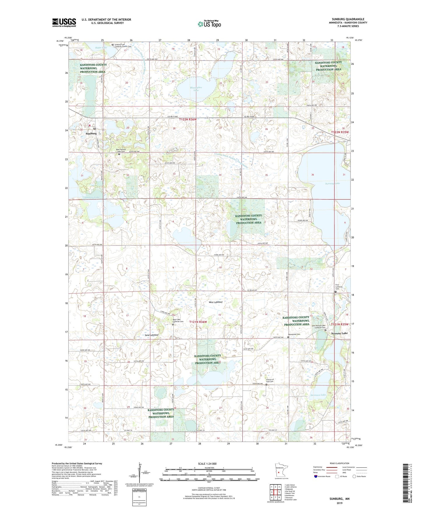
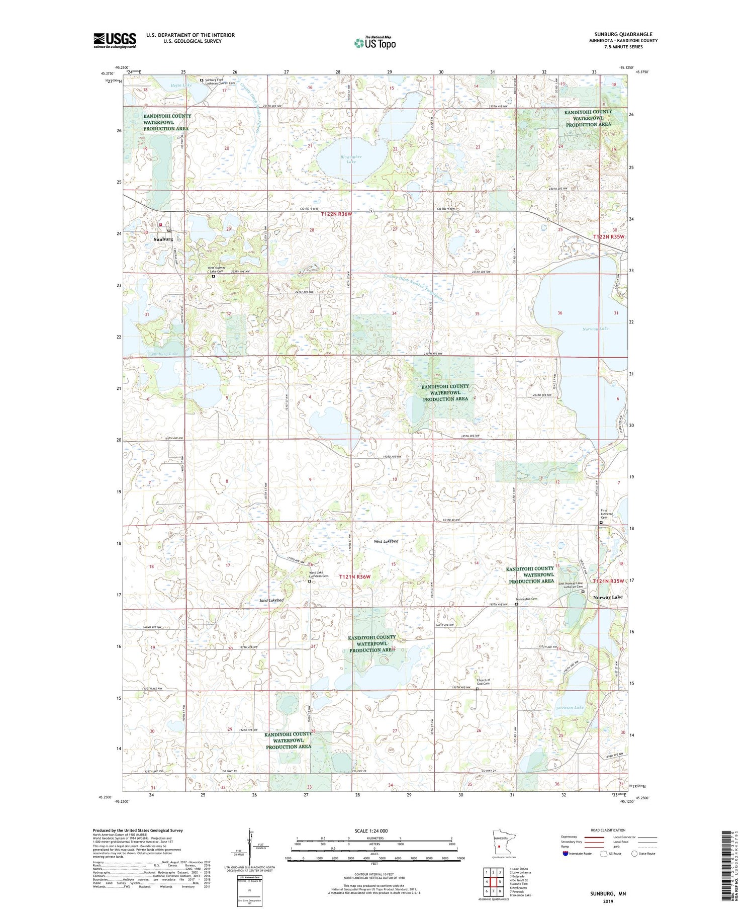
2019 topographic map quadrangle Sunburg in the state of Minnesota. Scale: 1:24000. Based on the newly updated USGS 7.5' US Topo map series, this map is in the following counties: Kandiyohi. The map contains contour data, water features, and other items you are used to seeing on USGS maps, but also has updated roads and other features. This is the next generation of topographic maps. Printed on high-quality waterproof paper with UV fade-resistant inks.
Quads adjacent to this one:
West: De Graff SE
Northwest: Lake Simon
North: Lake Johanna
Northeast: Belgrade
East: Mount Tom
Southeast: Solomon Lake
South: Pennock
Southwest: Kerkhoven
Contains the following named places: Blaamyhre Lake, Church of God Cemetery, City of Sunburg, County Ditch Number Fifteen, County Ditch Number Twentynine, County Ditch Number Twentyseven, East Norway Lake Lutheran Cemetery, East Norway Lake Lutheran Church, First Lutheran Cemetery, First Lutheran Church, Glesne Lake, Hefta Lake, Hope Lutheran Church, Nannestad Cemetery, Norway Lake, Norway Lake Post Office, Oleander State Wildlife Management Area, Sand Lakebed, Sunburg, Sunburg Church, Sunburg Community Bible Church, Sunburg Fire Department, Sunburg Free Lutheran Church Cemetery, Sunburg Lake, Sunburg Post Office, Sunburg Wildlife Management Area, Swenson Lake, Township of Arctander, Township of Norway Lake, West Lake Church, West Lake Lutheran Cemetery, West Lakebed, West Norway Lake Cemetery, West Norway Lake Church, ZIP Code: 56289