MyTopo
Theilman Minnesota US Topo Map
Couldn't load pickup availability
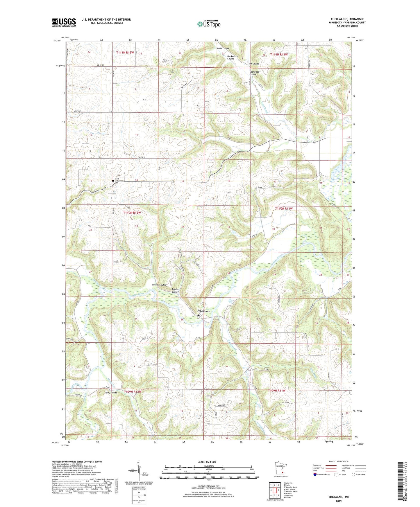
2019 topographic map quadrangle Theilman in the state of Minnesota. Scale: 1:24000. Based on the newly updated USGS 7.5' US Topo map series, this map is in the following counties: Wabasha. The map contains contour data, water features, and other items you are used to seeing on USGS maps, but also has updated roads and other features. This is the next generation of topographic maps. Printed on high-quality waterproof paper with UV fade-resistant inks.
Quads adjacent to this one:
West: West Albany
Northwest: Lake City
North: Pepin
Northeast: Wabasha North
East: Wabasha South
Southeast: Beaver
South: Plainview
Southwest: Millville
Contains the following named places: Bade Coulee, Carlson-Friermuth Detention Number 2 Dam, Cockwood Coulee, Dankwardt Coulee, Foley Mound, Free Coulee, L Kackman Dam, Long Creek, Middle Creek, Rattler Coulee, Sand Ditch, Scott Settlement Cemetery, Spring Creek, Sutton Coulee, Theilman, Theilman Post Office, Township of Glasgow, Township of West Albany, Wabasha County, West Indian Creek, Whippoorwill Ranch Kampground, Zell Creek, Zumbro State Wildlife Management Area