MyTopo
Two Inlets Minnesota US Topo Map
Couldn't load pickup availability
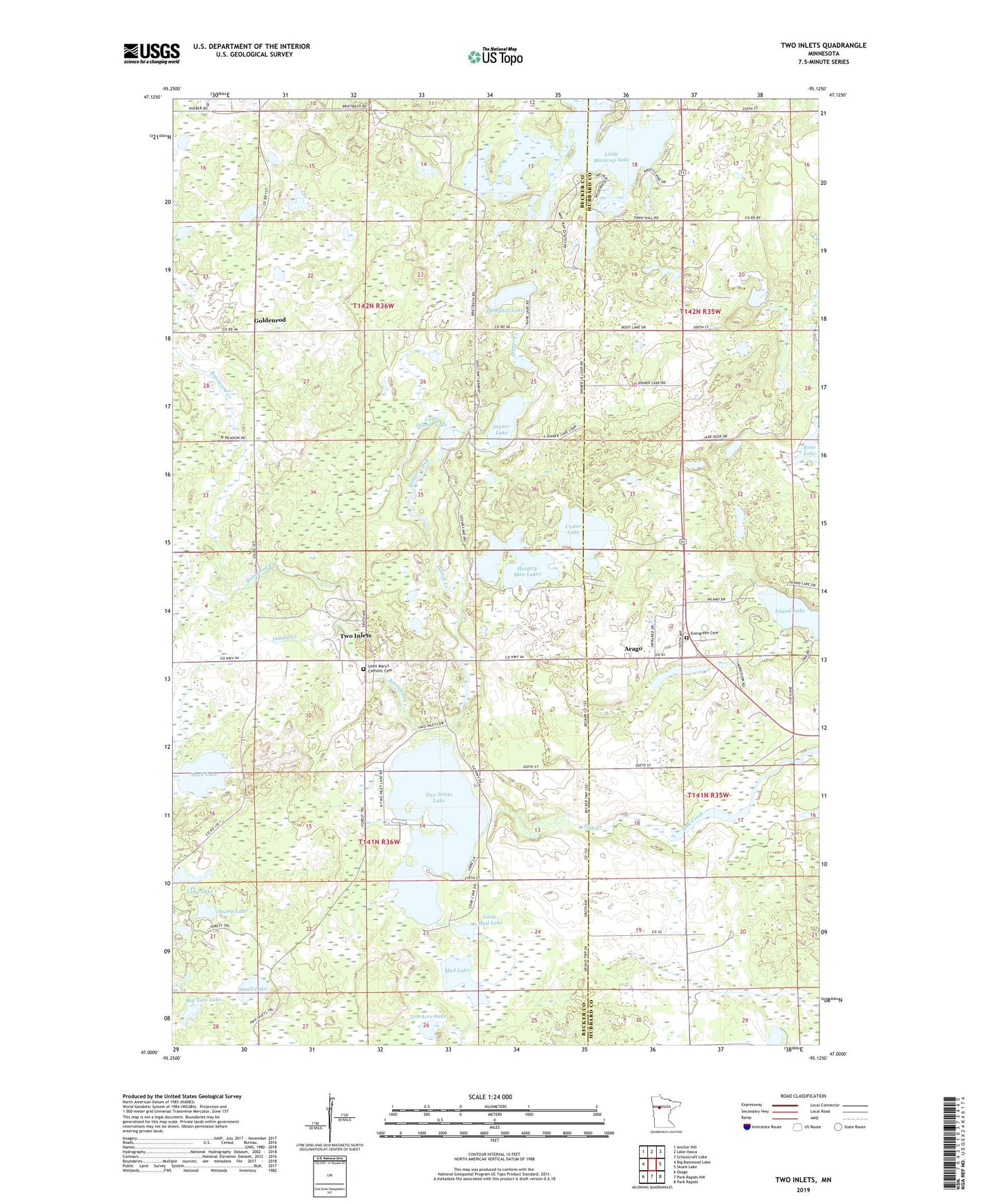
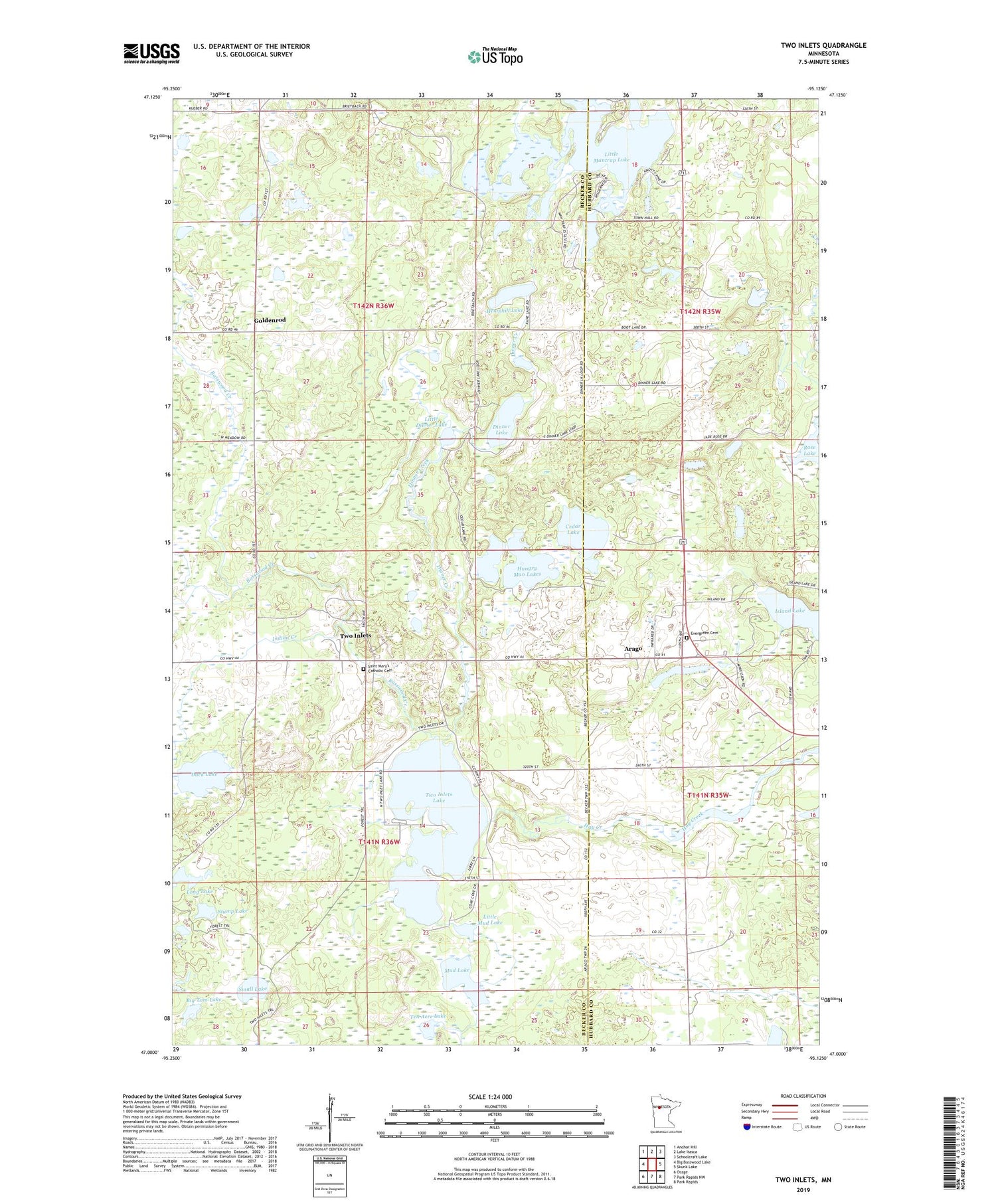
2019 topographic map quadrangle Two Inlets in the state of Minnesota. Scale: 1:24000. Based on the newly updated USGS 7.5' US Topo map series, this map is in the following counties: Becker, Hubbard. The map contains contour data, water features, and other items you are used to seeing on USGS maps, but also has updated roads and other features. This is the next generation of topographic maps. Printed on high-quality waterproof paper with UV fade-resistant inks.
Quads adjacent to this one:
West: Big Basswood Lake
Northwest: Anchor Hill
North: Lake Itasca
Northeast: Schoolcraft Lake
East: Skunk Lake
Southeast: Park Rapids
South: Park Rapids NW
Southwest: Osage
Contains the following named places: Arago, Arago Post Office, Basswood Creek, Big Tam Lake, Brookside Golf Course, Cedar Lake, Church of Saint Mary's, Dinner Creek, Dinner Lake, Duck Lake, Evergreen Cemetery, Goldenrod, Goldenrod Post Office, Hemphill Lake, Hungry Man Lakes, Indian Creek, Little Dinner Lake, Little Mantrap Lake, Little Mud Lake, Long Lake, Mud Lake, Rose Lake, Saint Mary's Catholic Cemetery, Small Lake, Stump Lake, Ten Acre Lake, Township of Savannah, Township of Two Inlets, Two Inlets, Two Inlets Lake, Two Inlets Lakes Dam, Two Inlets State Forest, Twoinlets Post Office, Wilderness Bay Resort and RV Campground