
MyTopo
Tyler Minnesota US Topo Map
Couldn't load pickup availability
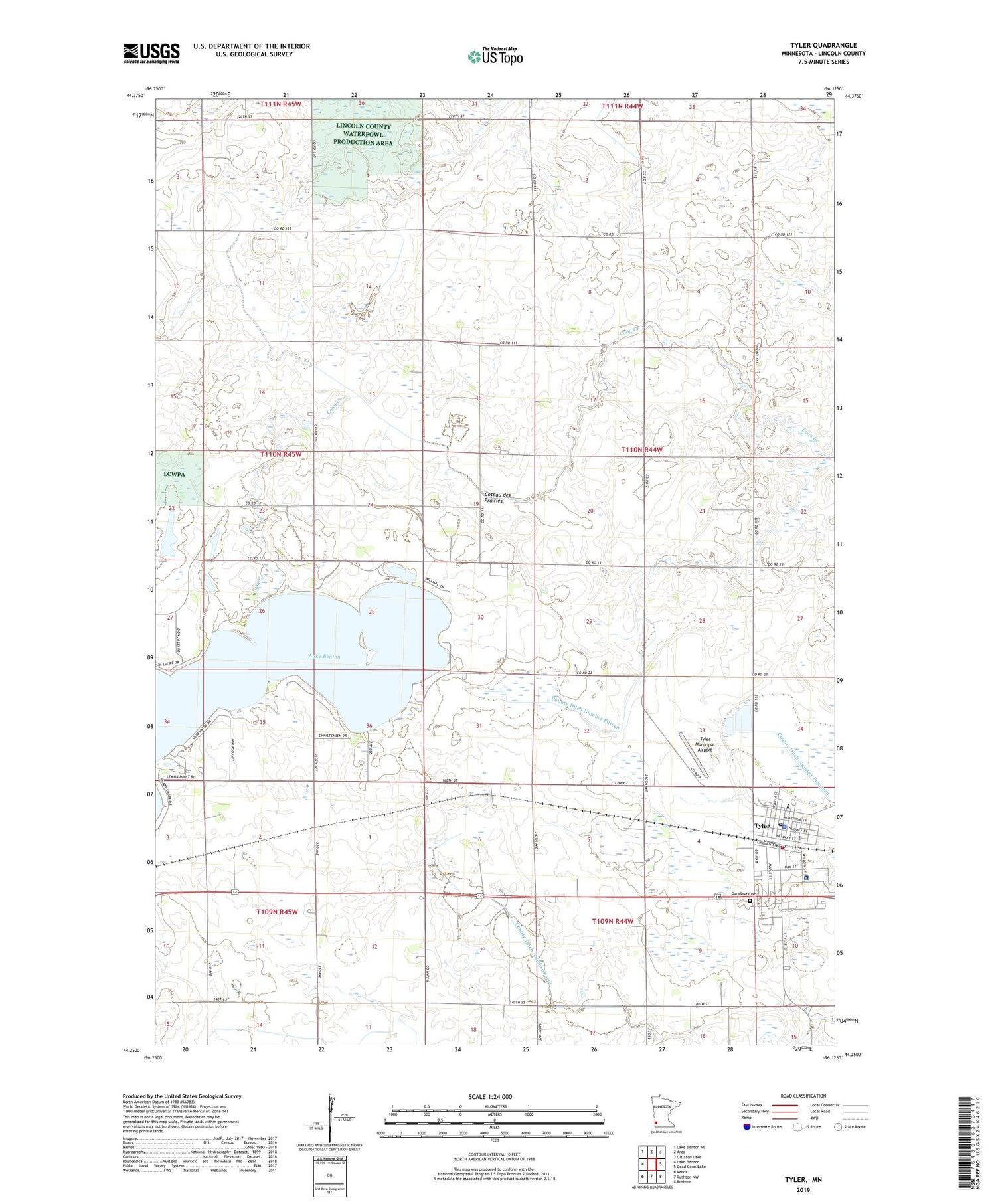
2019 topographic map quadrangle Tyler in the state of Minnesota. Scale: 1:24000. Based on the newly updated USGS 7.5' US Topo map series, this map is in the following counties: Lincoln. The map contains contour data, water features, and other items you are used to seeing on USGS maps, but also has updated roads and other features. This is the next generation of topographic maps. Printed on high-quality waterproof paper with UV fade-resistant inks.
Quads adjacent to this one:
West: Lake Benton
Northwest: Lake Benton NE
North: Arco
Northeast: Gislason Lake
East: Dead Coon Lake
Southeast: Ruthton
South: Ruthton NW
Southwest: Verdi
Contains the following named places: Alliance Church, Avera Tyler Hospital, Chen-Bay State Wildlife Management Area, City of Tyler, County Ditch Number Fifteen, County Ditch Number Forty, County Ditch Number Four, Danebod Cemetery, Danebod Lutheran Church, First Baptist Church, First English Lutheran Church, Immanuel Lutheran Church, Judicial Ditch Number Thirty, Lake Benton, Lincoln County Fairgrounds, Lincoln County Waterfowl Production Area, Lions Club Park, Saint Dionysius Catholic Church, Sunrise Manor Nursing Home, Township of Marshfield, Tyler, Tyler Ambulance Service, Tyler City Hall, Tyler City Park, Tyler Community Golf Club, Tyler Fire Department, Tyler Medical Clinic, Tyler Municipal Airport, Tyler Police Department, Tyler Post Office, Tyler Public Llibrary, Tyler Public Schools, ZIP Code: 56178


