MyTopo
Upper Rice Lake Minnesota US Topo Map
Couldn't load pickup availability
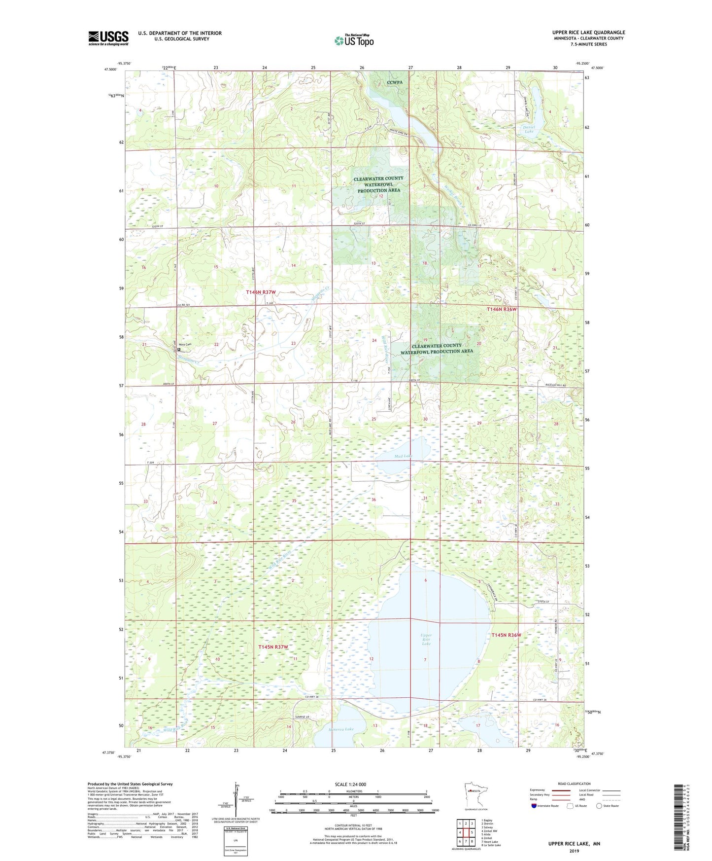
2019 topographic map quadrangle Upper Rice Lake in the state of Minnesota. Scale: 1:24000. Based on the newly updated USGS 7.5' US Topo map series, this map is in the following counties: Clearwater. The map contains contour data, water features, and other items you are used to seeing on USGS maps, but also has updated roads and other features. This is the next generation of topographic maps. Printed on high-quality waterproof paper with UV fade-resistant inks.
Quads adjacent to this one:
West: Zerkel NW
Northwest: Bagley
North: Shevlin
Northeast: Solway
East: Alida
Southeast: La Salle Lake
South: Heart Lake
Southwest: Zerkel
Contains the following named places: Bethel Church, Clearwater State Wildlife Management Area, Daniel Lake, Minerva Lake, Mud Lake, Nora Cemetery, Rice Lake Upper, Rice Lake Upper Dam, Township of Nora, Upper Rice Lake, Upper Rice Lake State Wildlife Management Ar, Walker Brook Lake, White Earth State Forest