MyTopo
Ward Springs Minnesota US Topo Map
Couldn't load pickup availability
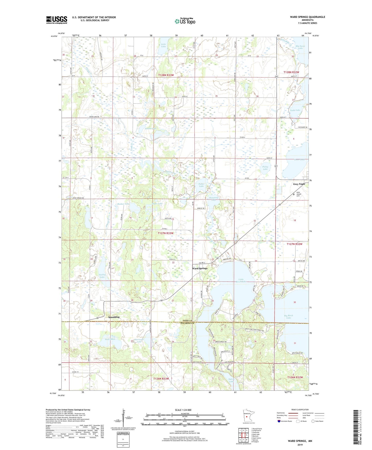
2019 topographic map quadrangle Ward Springs in the state of Minnesota. Scale: 1:24000. Based on the newly updated USGS 7.5' US Topo map series, this map is in the following counties: Todd, Stearns. The map contains contour data, water features, and other items you are used to seeing on USGS maps, but also has updated roads and other features. This is the next generation of topographic maps. Printed on high-quality waterproof paper with UV fade-resistant inks.
Quads adjacent to this one:
West: Sauk Lake
Northwest: Round Prairie
North: Long Prairie
Northeast: Swanville
East: Burtrum
Southeast: Freeport
South: Melrose
Southwest: Sauk Centre
Contains the following named places: Big Birch Lake, Big Birch Lake Dam, Birch Lakes State Forest, Bunker Lake, D Peschel Pond, D Peschel Pond Dam, Feucht Lake, Fuller Lake, Grey Eagle, Hartnette Lake, Hennessy Lake, Little Birch Lake, Pauley Lake, Pixley Lake, Prairie Creek, Saint Joseph Cemetery, Saint Joseph's Catholic Church, Schafer Lake, School Number 2260, School Number 2269, School Number 2275, Schwanke Creek, Spaulding, Stub Lakes, Sylvia Lake, Township of Birchdale, Trace Lake, Trout Creek, Ward Springs, Ward Springs Post Office, Zager Lake, ZIP Code: 56336