MyTopo
Wheaton NW Minnesota US Topo Map
Couldn't load pickup availability
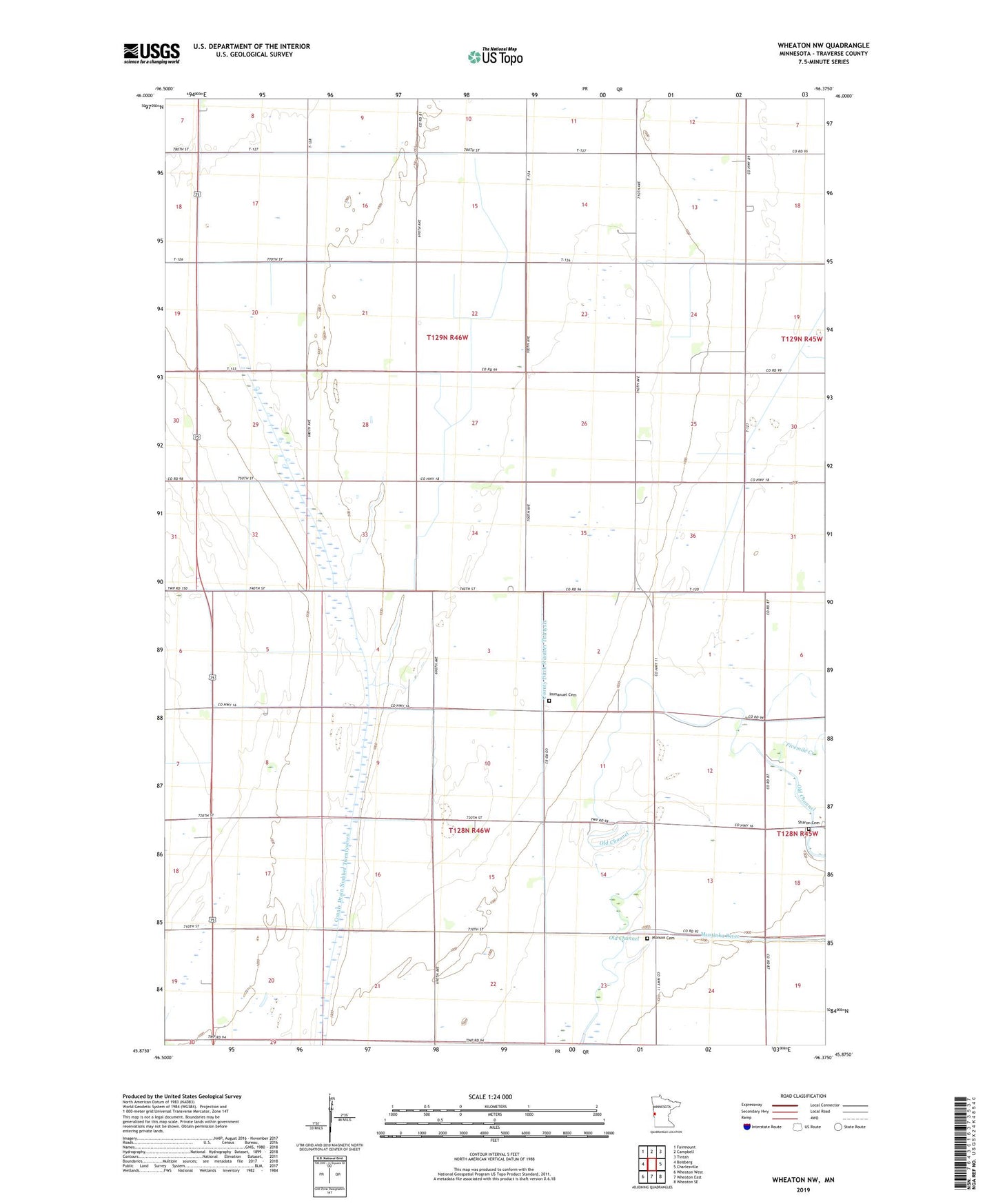
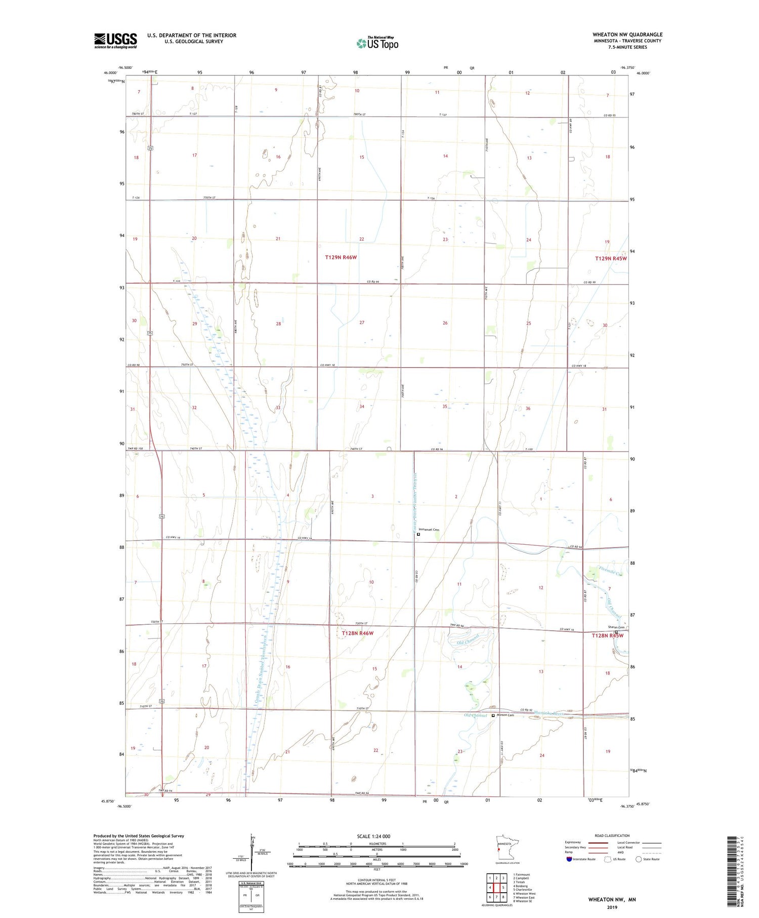
2019 topographic map quadrangle Wheaton NW in the state of Minnesota. Scale: 1:24000. Based on the newly updated USGS 7.5' US Topo map series, this map is in the following counties: Traverse. The map contains contour data, water features, and other items you are used to seeing on USGS maps, but also has updated roads and other features. This is the next generation of topographic maps. Printed on high-quality waterproof paper with UV fade-resistant inks.
Quads adjacent to this one:
West: Boisberg
Northwest: Fairmount
North: Campbell
Northeast: Tintah
East: Charlesville
Southeast: Wheaton SE
South: Wheaton East
Southwest: Wheaton West
Contains the following named places: County Ditch Number Thirteen, County Ditch Number Thirtysix, County Drain Number Twentyseven, Fivemile Creek, Immanuel Cemetery, Immanuel Church, Monson Cemetery, Old Channel, School Number 17, School Number 27, School Number 28, School Number 37, School Number 46, School Number 52, School Number 60, Sharon Cemetery, Taylor Church, Township of Monson, Township of Taylor, Traverse Air Airport