MyTopo
Zumbro Falls Minnesota US Topo Map
Couldn't load pickup availability
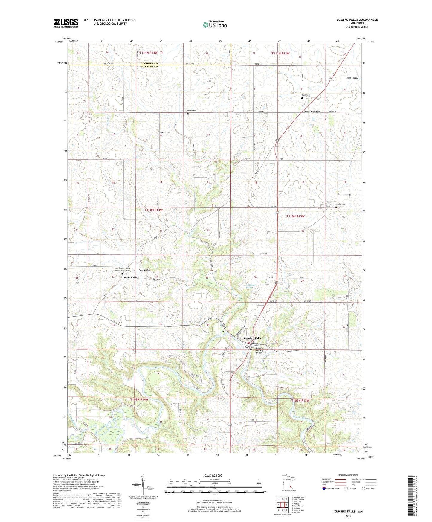
2019 topographic map quadrangle Zumbro Falls in the state of Minnesota. Scale: 1:24000. Based on the newly updated USGS 7.5' US Topo map series, this map is in the following counties: Wabasha, Goodhue. The map contains contour data, water features, and other items you are used to seeing on USGS maps, but also has updated roads and other features. This is the next generation of topographic maps. Printed on high-quality waterproof paper with UV fade-resistant inks.
Quads adjacent to this one:
West: Mazeppa
Northwest: Goodhue East
North: Lake City NW
Northeast: Lake City
East: West Albany
Southeast: Millville
South: Zumbro Lake
Southwest: Oronoco
Contains the following named places: Bear Valley, Bear Valley Cemetery, Bear Valley Post Office, Black Cemetery, Bluff Valley Campgrounds, Buckman Coulee, Chester Cemetery, City of Zumbro Falls, Cold Brook Spring, Cold Creek, English Cemetery, Lincoln Church, Mazeppa State Wildlife Management Area, North Fork Zumbro River, Oak Center, Oak Center Post Office, Saint John's Bear Valley Lutheran Church, Saint John's Lutheran Cemetery, Structure S-16A Dam, Township of Chester, Trinity Lutheran Cemetery, Trout Brook, Zumbro Community Church, Zumbro Falls, Zumbro Falls City Hall, Zumbro Falls Fire Department, Zumbro Falls Golf Club, Zumbro Falls Post Office, Zumbro Parkway Bridge, ZIP Code: 55991