MyTopo
Arkabutla West Mississippi US Topo Map
Couldn't load pickup availability
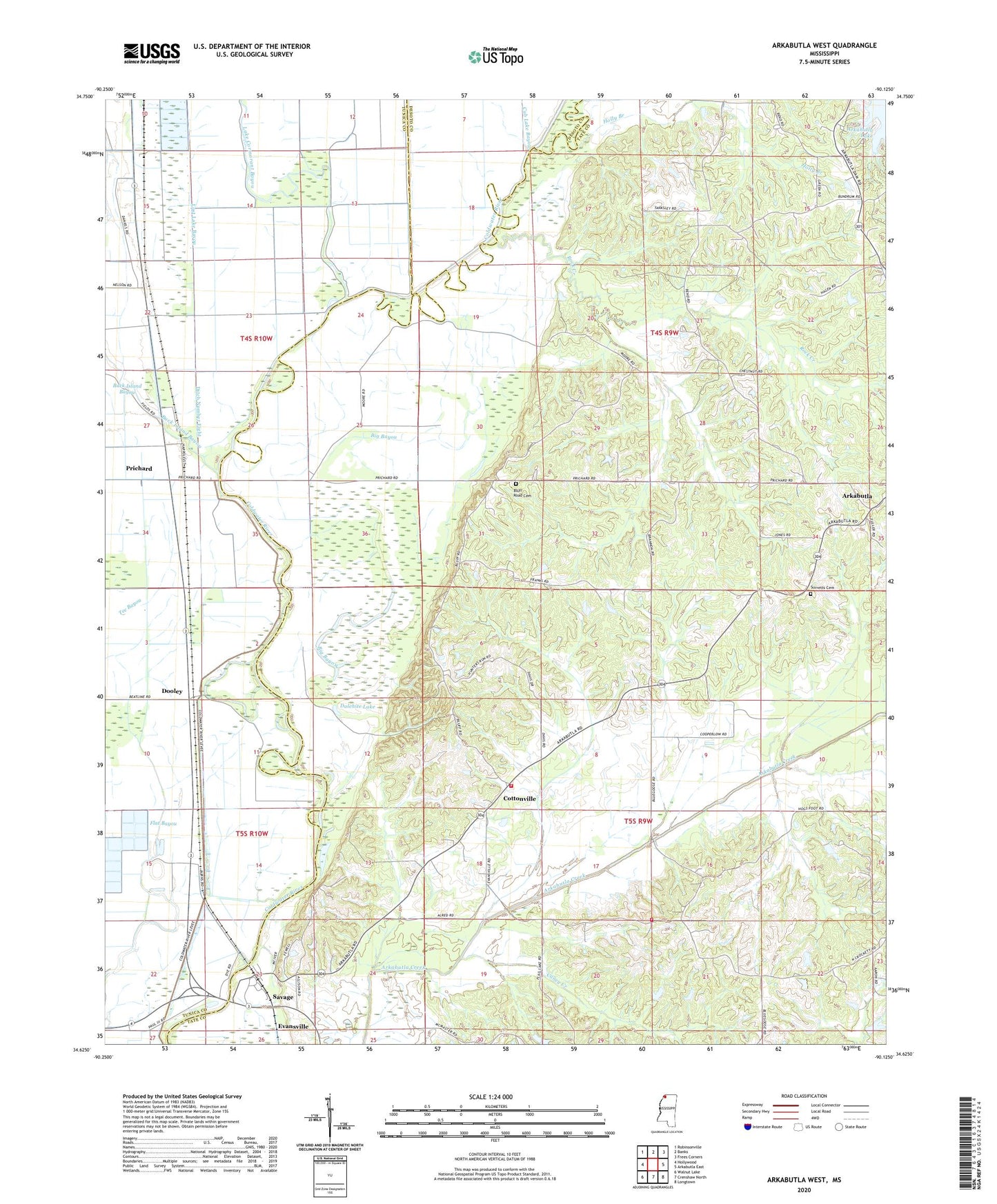
2020 topographic map quadrangle Arkabutla West in the state of Mississippi. Scale: 1:24000. Based on the newly updated USGS 7.5' US Topo map series, this map is in the following counties: Tate, Tunica, DeSoto. The map contains contour data, water features, and other items you are used to seeing on USGS maps, but also has updated roads and other features. This is the next generation of topographic maps. Printed on high-quality waterproof paper with UV fade-resistant inks.
Quads adjacent to this one:
West: Hollywood
Northwest: Robinsonville
North: Banks
Northeast: Frees Corners
East: Arkabutla East
Southeast: Longtown
South: Crenshaw North
Southwest: Walnut Lake
Contains the following named places: Arkabutla Consolidated High School, Arkabutla Fire Department, Big Bayou, Bill McLean Pond Dam, Blue Hill Church, Caney Creek, Center Hill Church, Church of Christ, Cottonville, Cub Lake Bayou, Dalehite Lake, District One Volunteer Fire Department Station 2, Ditch Number Eight, Dooley, E L Herron Pond Dam, Ella Green School, Evansville, Evansville Church, Flat Bayou, Forrest Tower, Green Church, Holly Branch, Hudsons Ferry, Lake Cormorant Bayou, Long Lake, Lost Lake Bayou, Mid-South College, Mosquito Lake, Mud Lake, Northwest Academy, Powell School, Prichard, Rock Creek, Round Lake, Saint Maryland Church, Savage, Smith Chapel, South Abutment Public Use Area, Sturdy School, Supervisor District 2, Surretts Cemetery, Tee Bayou, The Shepard Church, Thompsons Ferry