MyTopo
Beans Ferry Mississippi US Topo Map
Couldn't load pickup availability
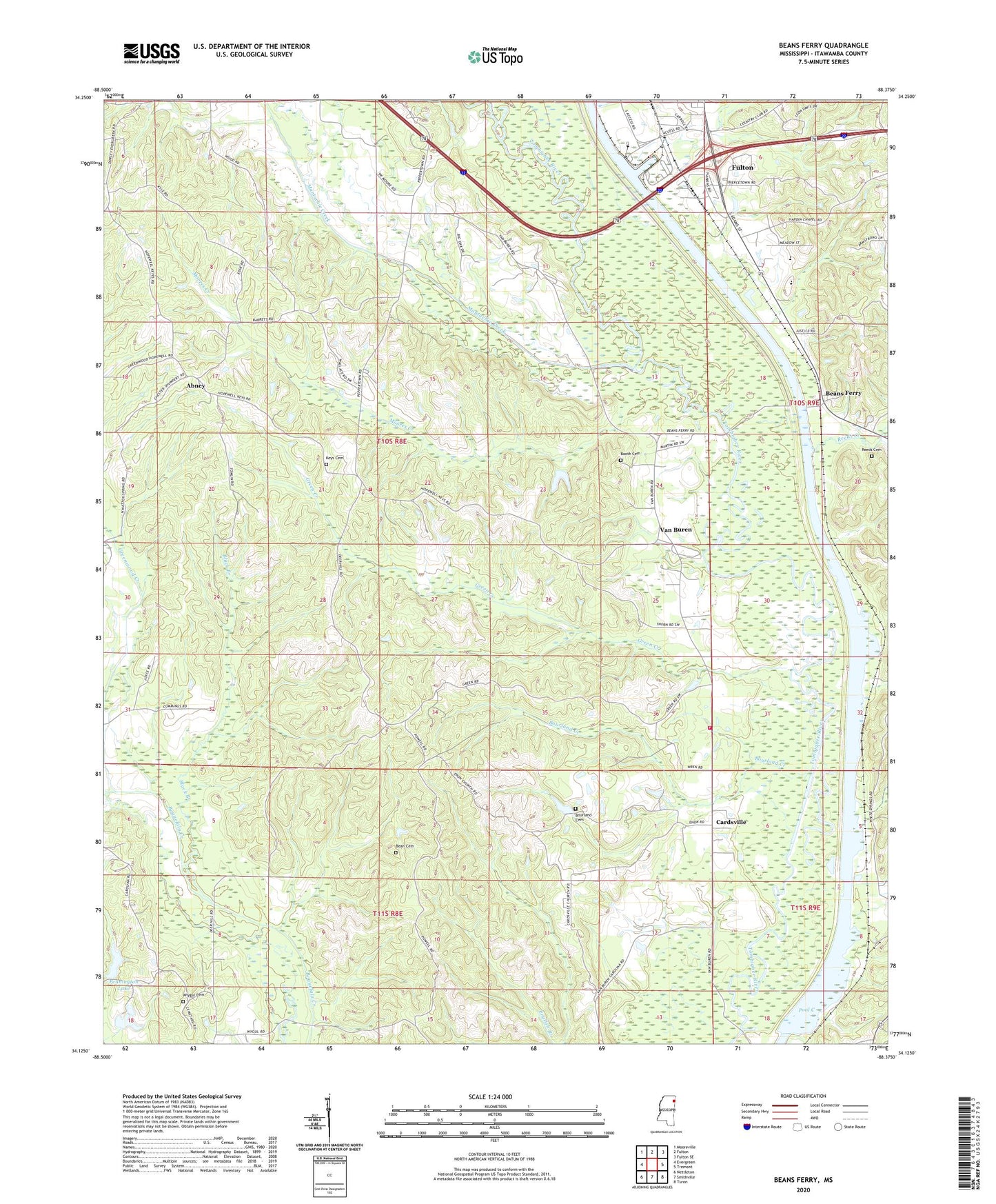
2020 topographic map quadrangle Beans Ferry in the state of Mississippi. Scale: 1:24000. Based on the newly updated USGS 7.5' US Topo map series, this map is in the following counties: Itawamba. The map contains contour data, water features, and other items you are used to seeing on USGS maps, but also has updated roads and other features. This is the next generation of topographic maps. Printed on high-quality waterproof paper with UV fade-resistant inks.
Quads adjacent to this one:
West: Evergreen
Northwest: Mooreville
North: Fulton
Northeast: Fulton SE
East: Tremont
Southeast: Turon
South: Smithville
Southwest: Nettleton
Contains the following named places: Abney, Bean Cemetery, Beans Ferry, Beans Ferry Church of Christ, Beenes Ferry, Black Branch, Booth Cemetery, Bourland Cemetery, Bourland Creek, Cardsville, Cardsville Church, Cardsville Volunteer Fire Department, Carolina Church, Dorsey - Friendship Fire Department Hopewell Keys Station, Enon Church, Green Creek, Greenwood Creek, Henry Shackleford Lake Dam, Hopewell Church, Keys Cemetery, Keys Church, Mantachie Creek, McHenry Lookout Tower, Moores Creek, Muscadine Bower School, Pennington Lake, Pool C, Reeds Cemetery, Reeds Creek, Supervisor District 3, Van Buren, WFTO-AM (Fulton), Wheeling, White Springs, Wiygul Cemetery