MyTopo
Big Black Mississippi US Topo Map
Couldn't load pickup availability
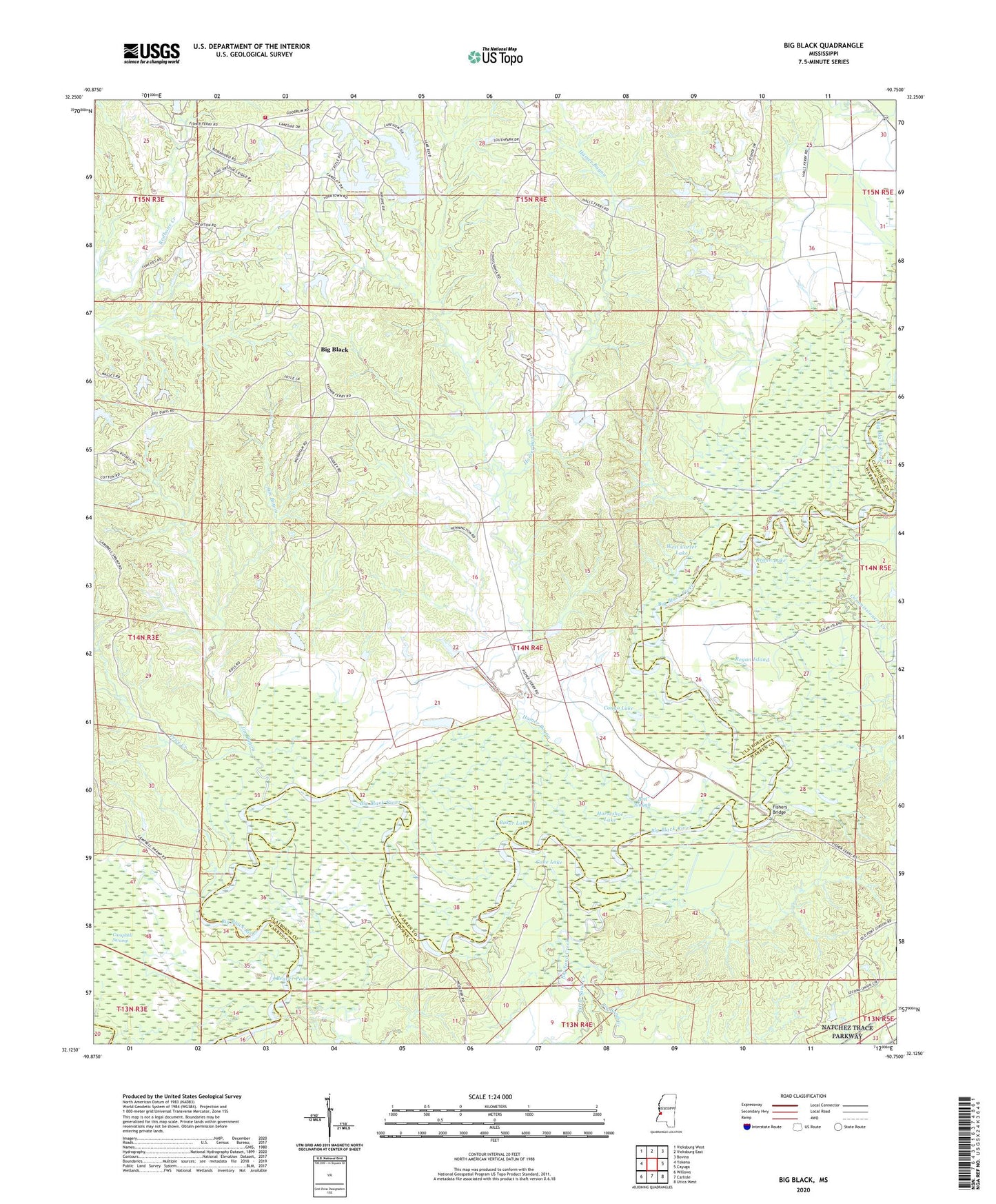
2020 topographic map quadrangle Big Black in the state of Mississippi. Scale: 1:24000. Based on the newly updated USGS 7.5' US Topo map series, this map is in the following counties: Warren, Claiborne. The map contains contour data, water features, and other items you are used to seeing on USGS maps, but also has updated roads and other features. This is the next generation of topographic maps. Printed on high-quality waterproof paper with UV fade-resistant inks.
Quads adjacent to this one:
West: Yokena
Northwest: Vicksburg West
North: Vicksburg East
Northeast: Bovina
East: Cayuga
Southeast: Utica West
South: Carlisle
Southwest: Willows
Contains the following named places: Antioch, Antioch Church, Asberry Church, Baker Lake, Beaver Pond, Ben Slough, Big Black, Big Sand Creek, Campbell Swamp, Cane Lake, Commissioners Creek, Congo Lake, E E Wallis Pond Dam, Fisher Ferry Volunteer Fire Department, Fishers Bridge, Goodrum Church, Halls Ferry, Hamer Bayou, Horners Ferry, Horseshoe Lake, Ivanhoe Bridge, Jim Bayou, Lake Park, Leroy George Lake Dam, Little Sand Creek, McKee Creek, Mount Pilgrim School, New Lake Park Dam, Old Lake Park Dam, Pear Orchard Plantation, Pleasant Hill Church, Price Creek, Providence Church, Ragsdall Creek, Range Line School, Regan Island, Regan Lake, Rose Hill Church, Saint Paul Baptist Church, Second Union Church, Second Union School, Sherwood Forest, Spring Plains, Timberlane, Twin Halls Plantation, W R Farris Lake Dam, W R Farris Pond Dam, Wayside Church, West Carter Lake, WQMV-FM (Vicksburg), ZIP Code: 39180