MyTopo
Courtland Mississippi US Topo Map
Couldn't load pickup availability
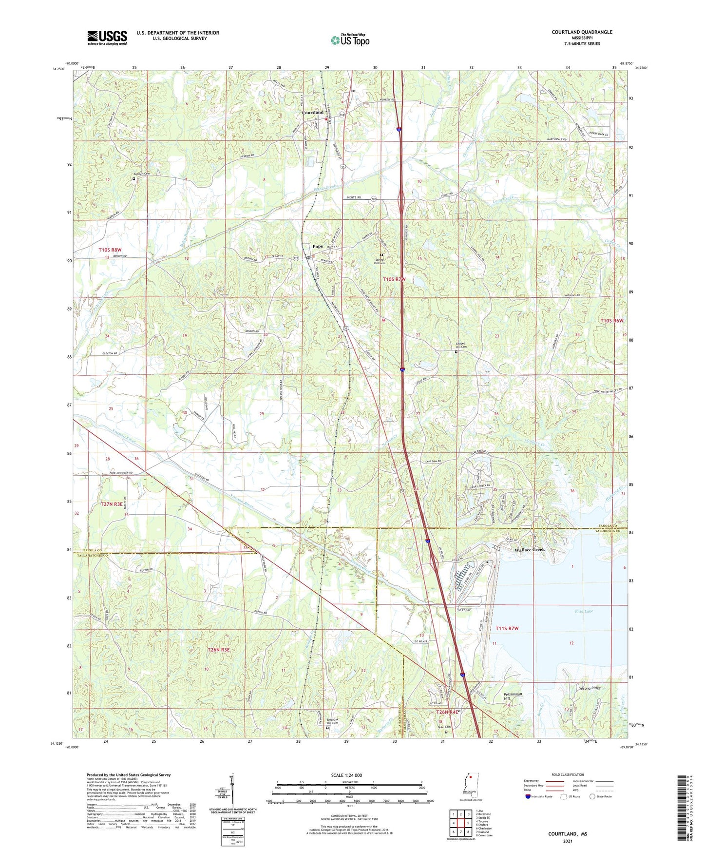
2021 topographic map quadrangle Courtland in the state of Mississippi. Scale: 1:24000. Based on the newly updated USGS 7.5' US Topo map series, this map is in the following counties: Panola, Tallahatchie, Yalobusha. The map contains contour data, water features, and other items you are used to seeing on USGS maps, but also has updated roads and other features. This is the next generation of topographic maps. Printed on high-quality waterproof paper with UV fade-resistant inks.
Quads adjacent to this one:
West: Tocowa
Northwest: Asa
North: Batesville
Northeast: Sardis SE
East: Shuford
Southeast: Coker Lake
South: Oakland
Southwest: Charleston
Contains the following named places: Antioch Cemetery, Bean Creek, Bobo Bayou, Bridges Creek, Burgess Creek, California, Caney Creek, Chapel Hill Cemetery, Chapel Hill Church, Cossar State Park, Courtland, Courtland Baptist Church, Courtland Post Office, Courtland School, Courtland Volunteer Fire Department, Duke Cemetery, Enid Dam, Enid Oak Hill Cemetery, Enid Post Office, Goodwin Creek, Hubbard Chapel School, Hubbard Creek, Hurt Creek, Hygiena, Johnson Creek, Long Creek, Nelson Creek, Nelson School, Nelson Spur, New Deal School, Persimmon Hill, Persimmon Hill Church, Persimmon Hill Recreation Area, Persimmon Hill School, Pope, Pope Baptist Church, Pope Chapel, Pope Chapel School, Pope Post Office, Pope School, Pope Volunteer Fire Department, Riverview Recreation Area, Sacrifice Church, Spring Hill Cemetery, Spring Hill Church, Spring Hill School, Talliaferros Crossing, Town of Courtland, Village of Pope, Wallace Creek, Wallace Creek Recreation Area, Yocona Ridge, ZIP Codes: 38620, 38658