MyTopo
Eskridge Mississippi US Topo Map
Couldn't load pickup availability
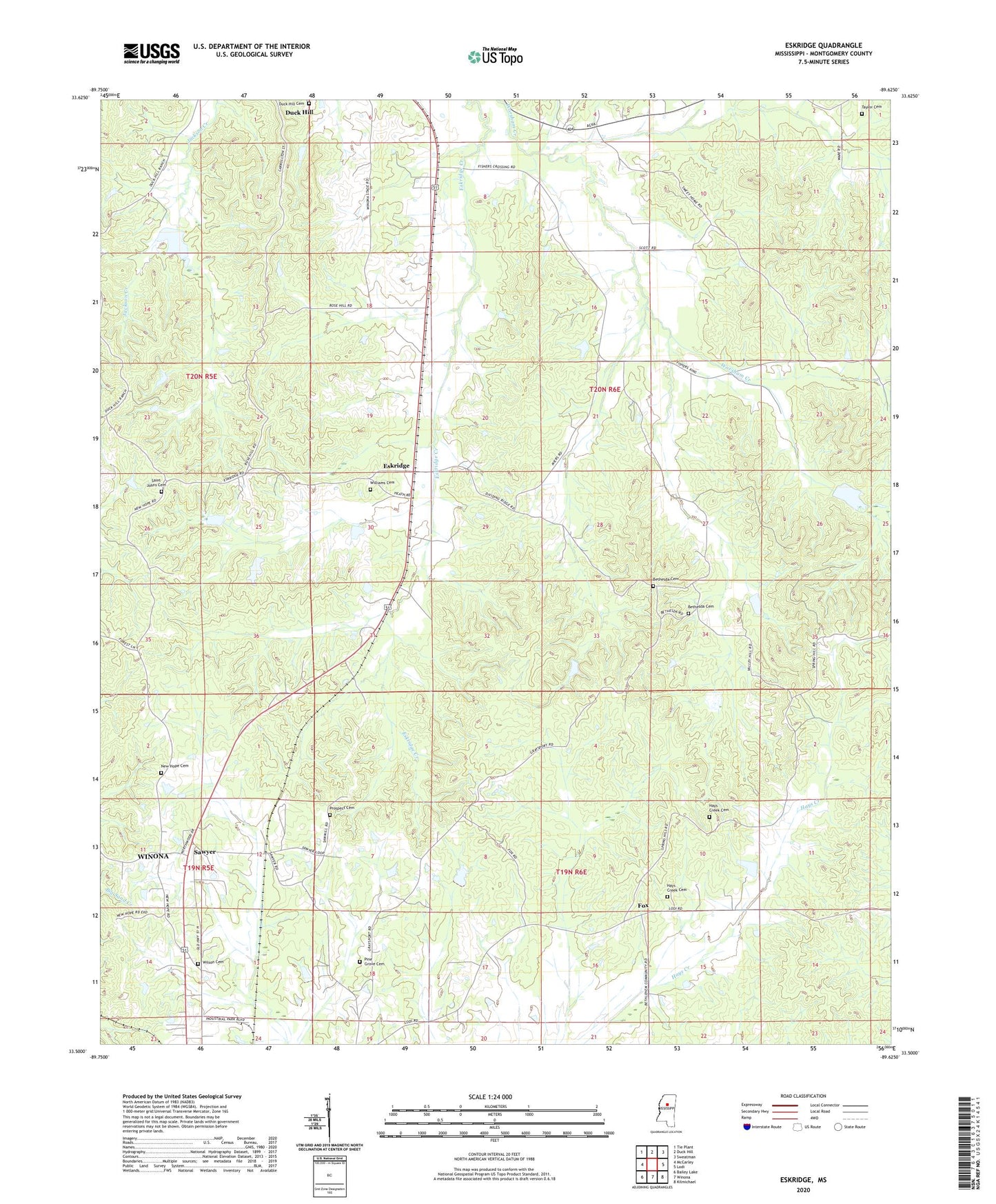
2020 topographic map quadrangle Eskridge in the state of Mississippi. Scale: 1:24000. Based on the newly updated USGS 7.5' US Topo map series, this map is in the following counties: Montgomery. The map contains contour data, water features, and other items you are used to seeing on USGS maps, but also has updated roads and other features. This is the next generation of topographic maps. Printed on high-quality waterproof paper with UV fade-resistant inks.
Quads adjacent to this one:
West: McCarley
Northwest: Tie Plant
North: Duck Hill
Northeast: Sweatman
East: Lodi
Southeast: Kilmichael
South: Winona
Southwest: Bailey Lake
Contains the following named places: Bethesda Cemetery, Bethesda Church, Binford, Blaylock Pond Dam, Bogue Watershed Y-30-31 Dam, Bogue Watershed Y-30-34 Dam, Bogue Watershed Y-30-94 Dam, Bogue Watershed Y-30-95 Dam, Duck Hill Cemetery, Eskridge, Eskridge Creek, Fox, G E Mason Catfish Pond Dam, G E Mason Catfish Ponds Dam, Hays Creek Cemetery, Hays Creek Church, Hays Creek School, Montgomery Lookout Tower, New Hope Church, New Hope Methodist Church Cemetery, Northside Church, Pine Grove Cemetery, Prospect Church, Prospect Church Cemetery, Prospect School, Saint Johns Cemetery, Saint Johns Church, Saint Johns School, Sawyer, Sweet Home Church, Sweet Home School, Taylor Cemetery, Williams Cemetery, Wilson Cemetery, Winona Baptist Temple