MyTopo
Grand Gulf Mississippi US Topo Map
Couldn't load pickup availability
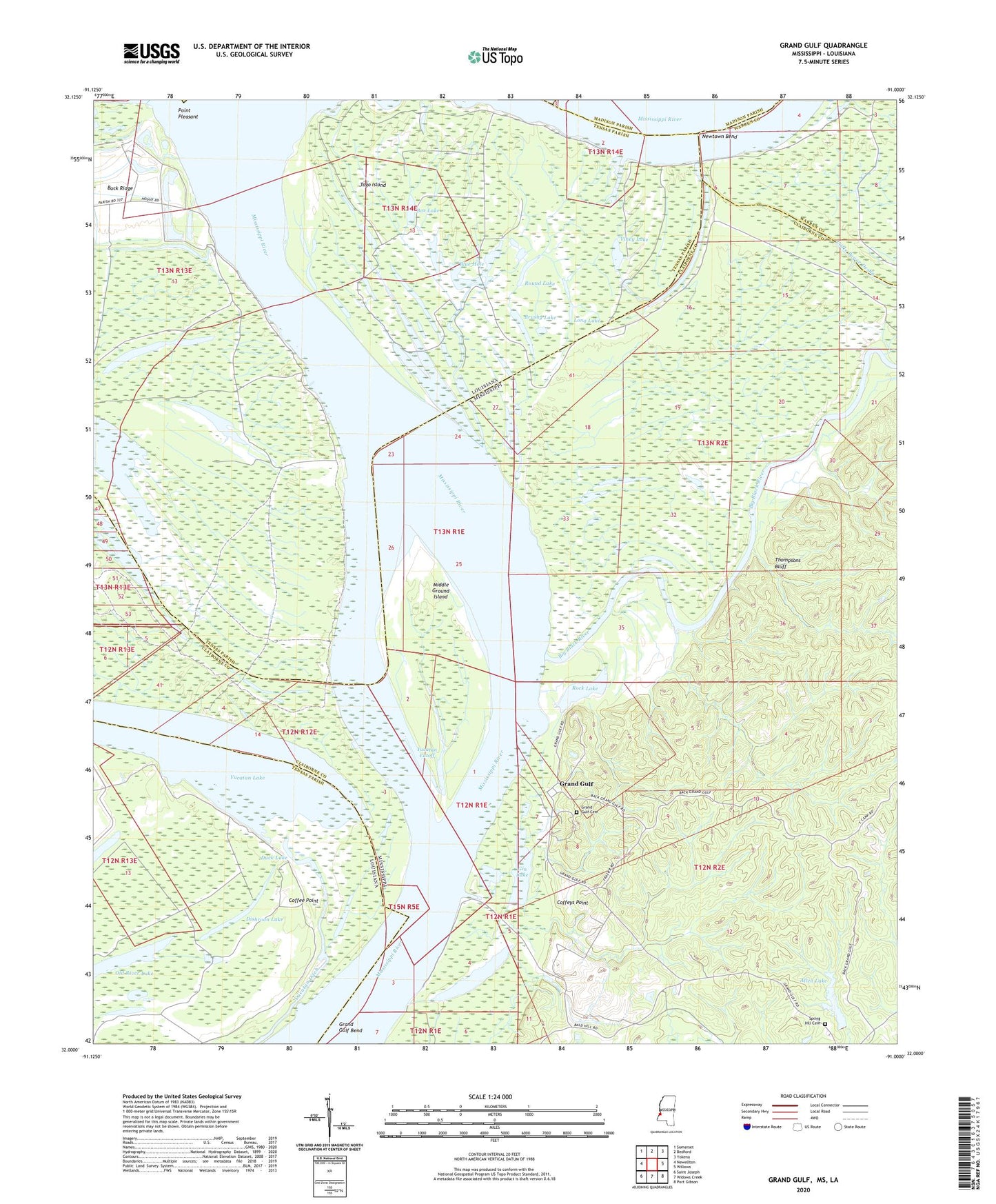
2020 topographic map quadrangle Grand Gulf in the states of Mississippi, Louisiana. Scale: 1:24000. Based on the newly updated USGS 7.5' US Topo map series, this map is in the following counties: Claiborne, Tensas, Warren, Madison. The map contains contour data, water features, and other items you are used to seeing on USGS maps, but also has updated roads and other features. This is the next generation of topographic maps. Printed on high-quality waterproof paper with UV fade-resistant inks.
Quads adjacent to this one:
West: Newellton
Northwest: Somerset
North: Bedford
Northeast: Yokena
East: Willows
Southeast: Port Gibson
South: Widows Creek
Southwest: Saint Joseph
Contains the following named places: Allen, Allen Lake, Allen Lake Dam, Bald Hill School, Bar Lake, Big Black River, Blue Hole, Brooks Landing, Brooks Light, Brushy Lake, Buckridge Landing, Buckridge Light, Burn Landing, Burn Plantation, Cannon Point Landing, Coffee Point, Coffeys Point, Colonel Coffey Plantation, Dishroon Lake, Dishroon Post Light, Duck Lake, Fort Cobun, Gin Lake, Grand Gulf, Grand Gulf Bend, Grand Gulf Cemetery, Grand Gulf Island, Grand Gulf Military Monument, Grand Gulf Nuclear Power Station, Hamilton Lake, Jerusalem Church, Lake Karnac, Lake Karnac Revetment, Long Lake, Lower Grand Gulf Landing, McKay Ferry, Middle Ground Island, Newtown Bend, Old River Lake, Point Pleasant, Rock Lake, Round Lake, Spring Hill Cemetery, Spring Hill Church, Supervisor District 2, Thompsons Bluff, Togo Island, Togo Landing, Upper Grand Gulf Landing, Viney Lake, Yucatan Cutoff, Yucatan Ditch, Yucatan Lake