MyTopo
Harperville Mississippi US Topo Map
Couldn't load pickup availability
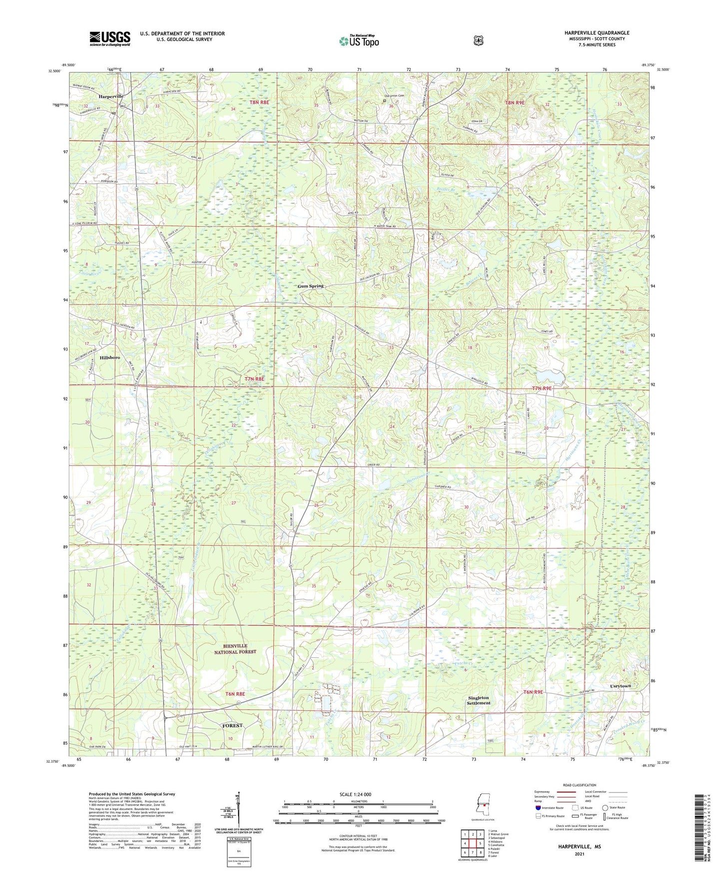
2021 topographic map quadrangle Harperville in the state of Mississippi. Scale: 1:24000. Based on the newly updated USGS 7.5' US Topo map series, this map is in the following counties: Scott. The map contains contour data, water features, and other items you are used to seeing on USGS maps, but also has updated roads and other features. This is the next generation of topographic maps. Printed on high-quality waterproof paper with UV fade-resistant inks.
Quads adjacent to this one:
West: Hillsboro
Northwest: Lena
North: Walnut Grove
Northeast: Sebastopol
East: Conehatta
Southeast: Lake
South: Forest
Southwest: Pulaski
Contains the following named places: Antioch Church, Beaver Creek, Bethel Church, Brister Branch, Burks Pond Dam, East Hillsboro, Ephesus Church, Eugene Carlton Pond Dam, Futchs Creek, Glover School, Gordy Branch, Gum Spring, Harperville, Harperville Baptist Church, Harperville Census Designated Place, Harperville Post Office, Hebron Church, Hillsboro Census Designated Place, Hurricane Creek, Liberty Church, Little Indian Branch, Little River, New Hope Church, Old Union Cemetery, Piney Grove School, Ringold School, Scott Central Elementary School, Scott Central School, Singleton Settlement, Steele, Steele Baptist Church, Supervisor District 5, Sylvester Church, Sylvester School, Union Grove Church, Usrytown, Village Square Shopping Center, Wolf, ZIP Code: 39074