MyTopo
Hillsboro Mississippi US Topo Map
Couldn't load pickup availability
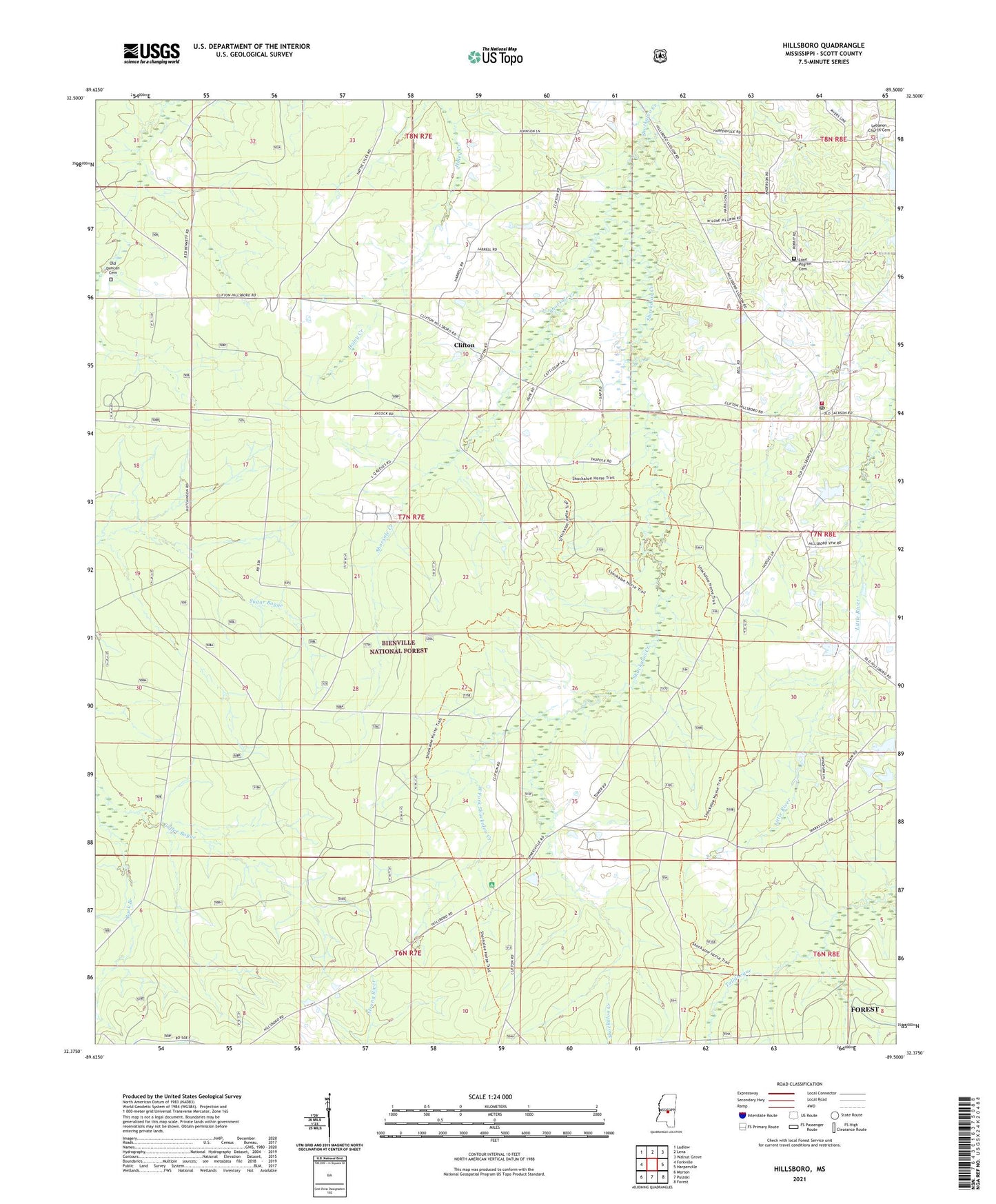
2021 topographic map quadrangle Hillsboro in the state of Mississippi. Scale: 1:24000. Based on the newly updated USGS 7.5' US Topo map series, this map is in the following counties: Scott. The map contains contour data, water features, and other items you are used to seeing on USGS maps, but also has updated roads and other features. This is the next generation of topographic maps. Printed on high-quality waterproof paper with UV fade-resistant inks.
Quads adjacent to this one:
West: Forkville
Northwest: Ludlow
North: Lena
Northeast: Walnut Grove
East: Harperville
Southeast: Forest
South: Pulaski
Southwest: Morton
Contains the following named places: Base Camp Two, Bienville State Wildlife Management Area, Clifton, Clifton Baptist Church, Fred Gaddis Lake, Fred Gaddis Lake Dam, Fred Gaddis Pond Dam, Hillsboro, Hillsboro Post Office, Hillsboro Volunteer Fire Department, Lebanon Church Cemetery, Lewis Eure Lake Dam, Lewis Eurie Lake Dam, Lone Pilgrim Cemetery, Lone Pilgrim Missionary Baptist Church, Macedonia Church, Mount Zion Church, Old Duncan Cemetery, Old Lillian, Scott County, Shockaloe Trail, Shoesole Creek, Supervisor District 1, West Fork Shockaloo Creek, Wilbur Weems Pond Dam