MyTopo
Hillsdale Mississippi US Topo Map
Couldn't load pickup availability
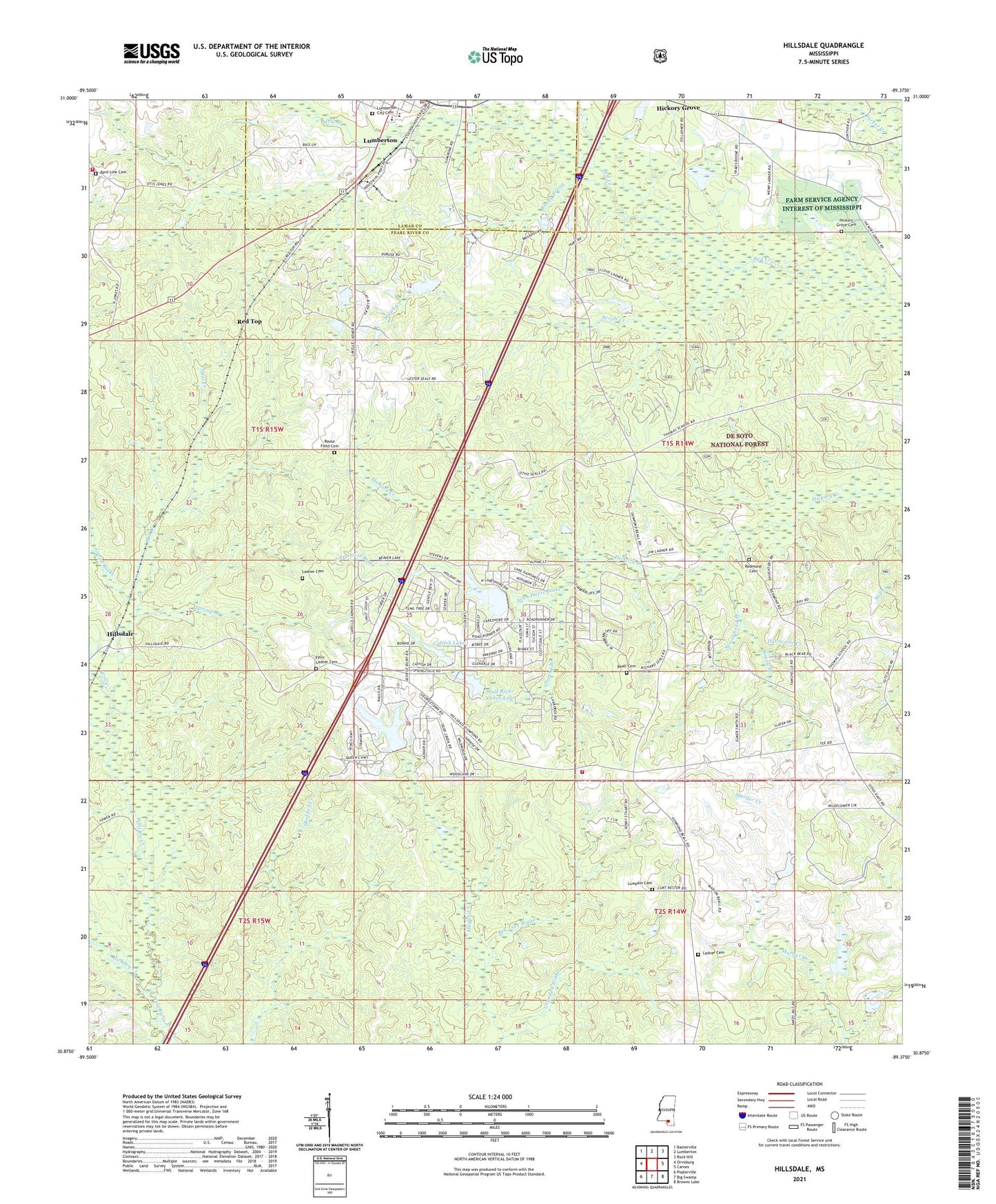
2021 topographic map quadrangle Hillsdale in the state of Mississippi. Scale: 1:24000. Based on the newly updated USGS 7.5' US Topo map series, this map is in the following counties: Pearl River, Lamar. The map contains contour data, water features, and other items you are used to seeing on USGS maps, but also has updated roads and other features. This is the next generation of topographic maps. Printed on high-quality waterproof paper with UV fade-resistant inks.
Quads adjacent to this one:
West: Orvisburg
Northwest: Baxterville
North: Lumberton
Northeast: Rock Hill
East: Carnes
Southeast: Browns Lake
South: Big Swamp
Southwest: Poplarville
Contains the following named places: Beall Cemetery, Bee Tree Brake, Boggy Branch, Bushy Prong, Byrd Line Cemetery, Byrd Line School, Carters Reed Brake, Catfish Lake, Dry Branch, Felix Ladner Cemetery, First Baptist Church, Grandpa Brake, Granny Branch, Green Brake, Gum Pond, Happiness Lake, Hickory Creek, Hickory Grove, Hickory Grove Cemetery, Hickory Grove Church, Hickory Grove School, Hillsdale, Hillsdale Golf Course, Hillsdale Lake, J M Rault Lake Dam, John Davis Brake, Ladner Cemetery, Lake Hills Golf Club, Lumberton City Cemetery, Lumberton Elementary School, Lumberton High School, Lumberton Police Department, Lumberton United Methodist Church, Lumpkin Cemetery, Mill Creek, North Central Volunteer Fire Department Station 2, Northeast Volunteer Fire Department Station 1 Headquarters, Northeast Volunteer Fire Department Station 2, Parker Creek, Pearl River County Emergency Communications North Repeater Site, Red Top, Redmond Cemetery, Rouse Field Cemetery, Scrub Creek, Spring Branch, Springhead Branch, Wolf Creek, Wolf River Ranch Airport, Wolf River Ranch Lake