MyTopo
Kincaid Mississippi US Topo Map
Couldn't load pickup availability
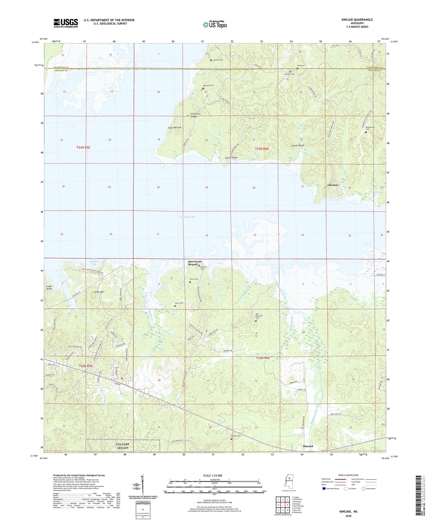
2020 topographic map quadrangle Kincaid in the state of Mississippi. Scale: 1:24000. Based on the newly updated USGS 7.5' US Topo map series, this map is in the following counties: Grenada, Yalobusha. The map contains contour data, water features, and other items you are used to seeing on USGS maps, but also has updated roads and other features. This is the next generation of topographic maps. Printed on high-quality waterproof paper with UV fade-resistant inks.
Quads adjacent to this one:
West: Grenada
Northwest: Scobey
North: Coffeeville
Northeast: Benwood
East: Gore Springs
Southeast: Sweatman
South: Duck Hill
Southwest: Tie Plant
Contains the following named places: Barnard Cemetery, Bob Quarters Cemetery, Browns Cemetery, Bunion Church, Cape Retreat, Carver Bluff, Carver Point, Carver Point State Park, Choctaw, Choctaw Public Use Area, Crescent Ridge, Dodson Cemetery, Gore Springs Volunteer Fire Department Station 2, Grenada Lake, Hugh White State Park, Hurricane Branch, Keeton Lake Dam, Kincaid, Knight Creek, Little Mountain, Old Orchard Bay, Perry Cemetery, Phillips Lake Dam, Pinewood Landing, Piney Woods, Piney Woods Public Use Area, Redgrass Creek, Redgrass School, Rohnsville Church, Rounsaville Cemetery, Skuna River, Stevens Cemetery, Torrance, Wolf Creek Landing, Wolf Creek Public Use Area, York Cemetery, York Church