MyTopo
Kossuth North Mississippi US Topo Map
Couldn't load pickup availability
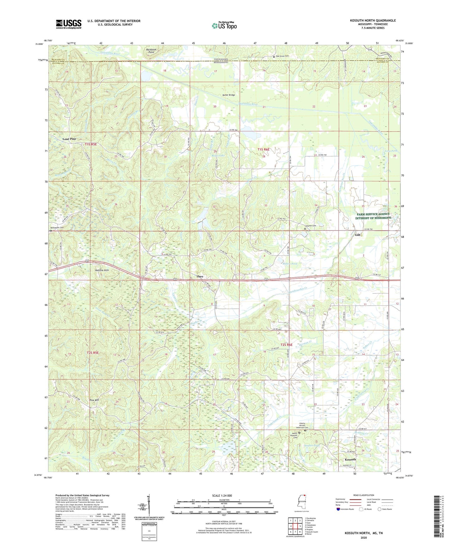
2020 topographic map quadrangle Kossuth North in the states of Mississippi, Tennessee. Scale: 1:24000. Based on the newly updated USGS 7.5' US Topo map series, this map is in the following counties: Alcorn, McNairy. The map contains contour data, water features, and other items you are used to seeing on USGS maps, but also has updated roads and other features. This is the next generation of topographic maps. Printed on high-quality waterproof paper with UV fade-resistant inks.
Quads adjacent to this one:
West: Chalybeate
Northwest: Pocahontas
North: Chewalla
Northeast: Guys
East: Corinth
Southeast: Rienzi
South: Kossuth South
Southwest: Peoples
Contains the following named places: Backbone Point, Bethlehem Cemetery, Boneyard, Boneyard School, Burns Lake, Butler Bridge, Carpenter School, Casin Creek, Coon Creek, Cuba, Deerlick School, Dixon Creek, Essley Branch, Eula School, Friendship Church, Gift, Gift School, Gwyna School, Hatchie Hills, Herman Creek, Hughes Branch, Hughes Pond, Kossuth Elementary School, Lambert Branch, Layton School, Lebanon Cemetery, Lebanon Methodist Church, Lick Branch, Lick Branch Church, Lone Pine, Long Pond, Millers Pond, Moccasin School, Mount Pleasant Cemetery, Nichols Branch, Oak Grove Cemetery, Oak Hill Church, Pine Mountain, Pine Mountain Lookout Tower, Pittman Branch, Shiloh Baptist Church, Shiloh Church, Supervisor District 5, Tarebreeches Creek, Theo, Theo Church, Tishomingo Chapel Baptist Church, Tuscumbia Baptist Church, Tuscumbia School, Underwood Creek, Youngs Bridge