MyTopo
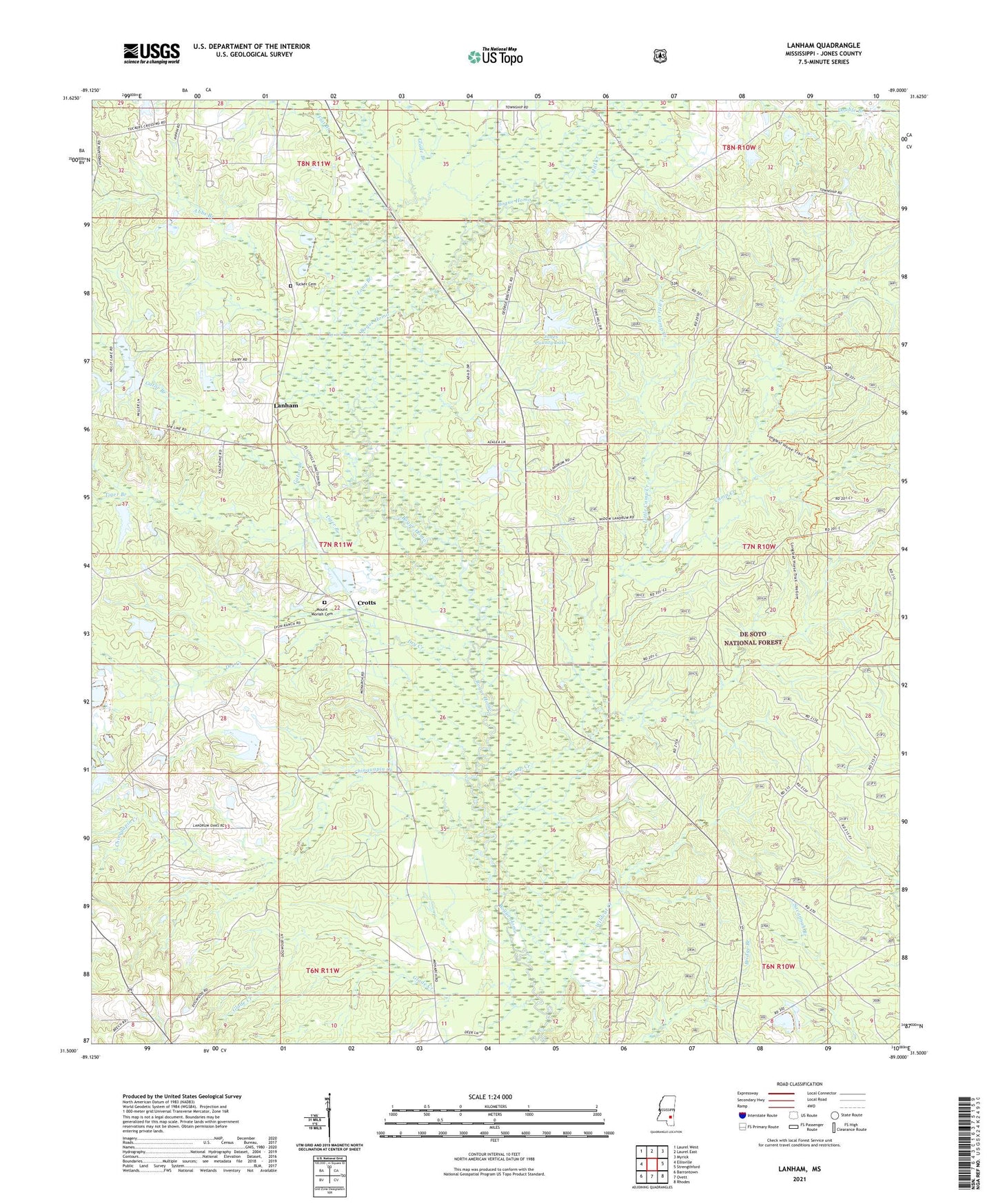
Lanham Mississippi US Topo Map
Couldn't load pickup availability
2021 topographic map quadrangle Lanham in the state of Mississippi. Scale: 1:24000. Based on the newly updated USGS 7.5' US Topo map series, this map is in the following counties: Jones. The map contains contour data, water features, and other items you are used to seeing on USGS maps, but also has updated roads and other features. This is the next generation of topographic maps. Printed on high-quality waterproof paper with UV fade-resistant inks.
Quads adjacent to this one:
West: Ellisville
Northwest: Laurel West
North: Laurel East
Northeast: Myrick
East: Strengthford
Southeast: Rhodes
South: Ovett
Southwest: Barrontown
Contains the following named places: Abbs Branch, Arnold Landrum Pond Dam, Bill Deavors Lake Dam, Bill Deavors Pond Dam, Camp Creek, Chinquapin Creek, Crotts, Dry Creek, Ellisville Junction, Flat Branch, Gator Branch, Geer Lake Dam, Glade Branch, Glade Creek, Good Hope Church, Jones County Lake, Jones County Lake Dam, Landrum School, Lanham, Little Camp Creek, Long Branch, Marlow Shoemake Dam, Mill Creek, Monarch, Mount Moriah Cemetery, Mount Moriah Landmark Missionary Baptist Church, Mount Moriah School, Pine Burr Ranch Lake, Point Laurel Lookout Tower, Tallahomo, Tiger Branch, Tucker Cemetery, Wildcat Creek