MyTopo
Laurel East Mississippi US Topo Map
Couldn't load pickup availability
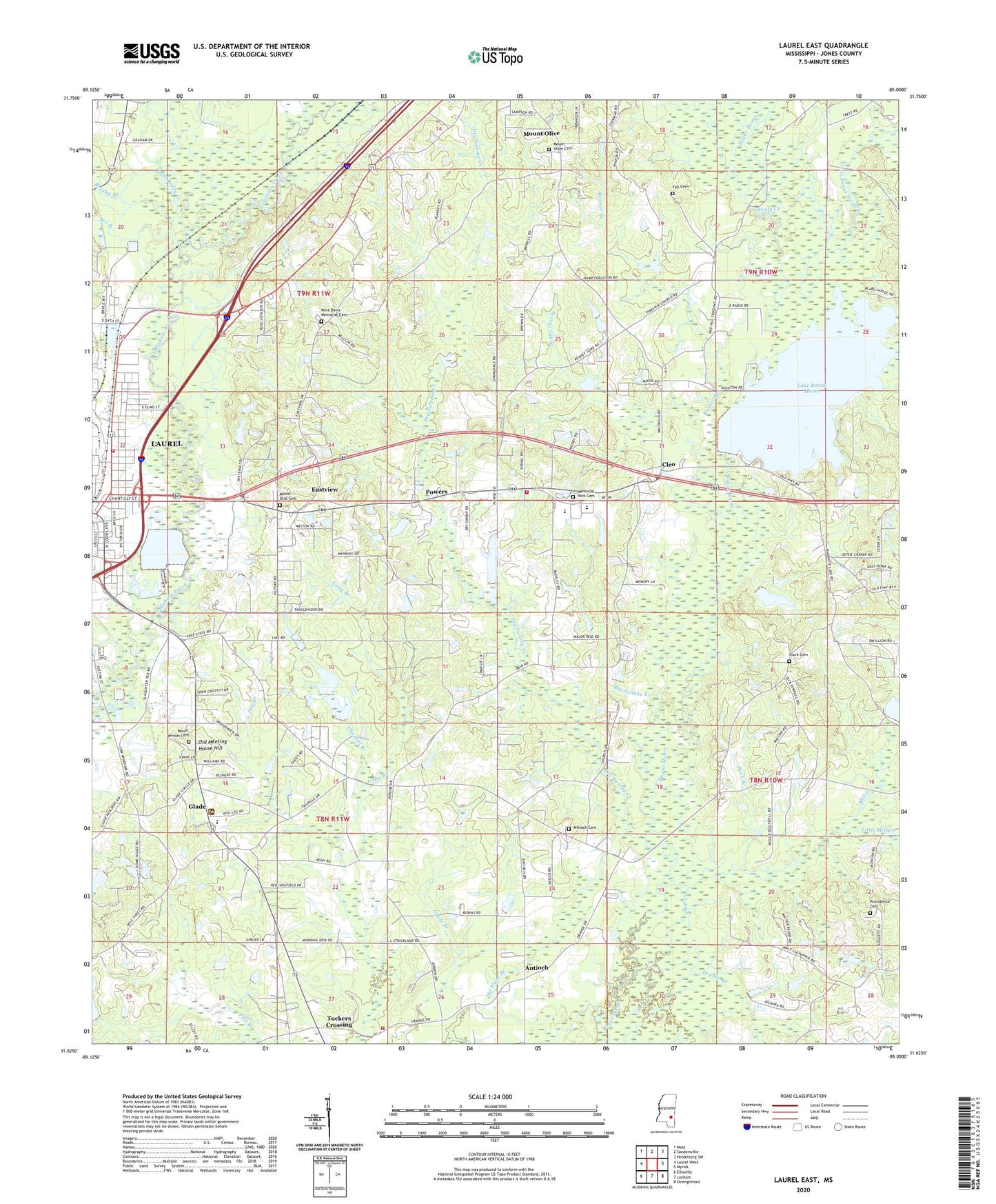
2020 topographic map quadrangle Laurel East in the state of Mississippi. Scale: 1:24000. Based on the newly updated USGS 7.5' US Topo map series, this map is in the following counties: Jones. The map contains contour data, water features, and other items you are used to seeing on USGS maps, but also has updated roads and other features. This is the next generation of topographic maps. Printed on high-quality waterproof paper with UV fade-resistant inks.
Quads adjacent to this one:
West: Laurel West
Northwest: Moss
North: Sandersville
Northeast: Heidelberg SW
East: Myrick
Southeast: Strengthford
South: Lanham
Southwest: Ellisville
Contains the following named places: Antioch, Antioch Cemetery, Antioch Church, Bee Branch, Bethlehem Baptist Church, Bethlehem School, Bible Baptist Church, Big Reedy Creek, Blacksnake Creek, Bogue Cheely, Brushy Branch, Buck Branch, Channel Branch, Church of God, Clark Cemetery, Cleo, Double Branch, Dry Branch, Dry Swamp Creek, East Jerusalem Baptist Church, East Pleasant Grove Church, Eastview, Emmanuel Baptist Church, Fall Cemetery, Glade, Glade Baptist Church, Glade Church, Glade Elementary School, Glade Volunteer Fire Department, Glaston, Goodwill Church, Hood Lumber Company Dam, Huddleston School, Lake Bogue Homo, Lake Bogue Homo Dam, Lake Church, Laurel Fire Department Station 2, Lawn Haven Baptist Church, Little Bogue Homo, Little Mill Creek, Longino School, Masonite Lake Dam, Memorial Park Cemetery, Morning Star Baptist Church, Mount Olive, Mount Olive Baptist Church, Mount Olive Cemetery, Mount Olive School, Mount Oral Baptist Church, Mount Oral Cemetery, Mount Vernon Cemetery, Mount Vernon Church, Mount Vernon School, Nora Davis Elementary School, Nora Davis Memorial Cemetery, Northeast Jones High School, Odoms Lake Dam, Old Meeting House Hill, Old Place Branch, Pine View Church, Pleasant Grove School, Pleasant Valley Missionary Baptist Church, Powers, Powers Elementary School, Powers Volunteer Fire Department, Providence Baptist Church, Providence Cemetery, Rashee Branch, Reedy Creek, Smiley Sewage Lagoon Dam, Smith Chapel, Supervisor District 3, Tuckers Crossing, Tuckers Crossing Baptist Church, WNSL-FM (Laurel), WQIS-AM (Laurel), ZIP Code: 39443