MyTopo
Laws Hill Mississippi US Topo Map
Couldn't load pickup availability
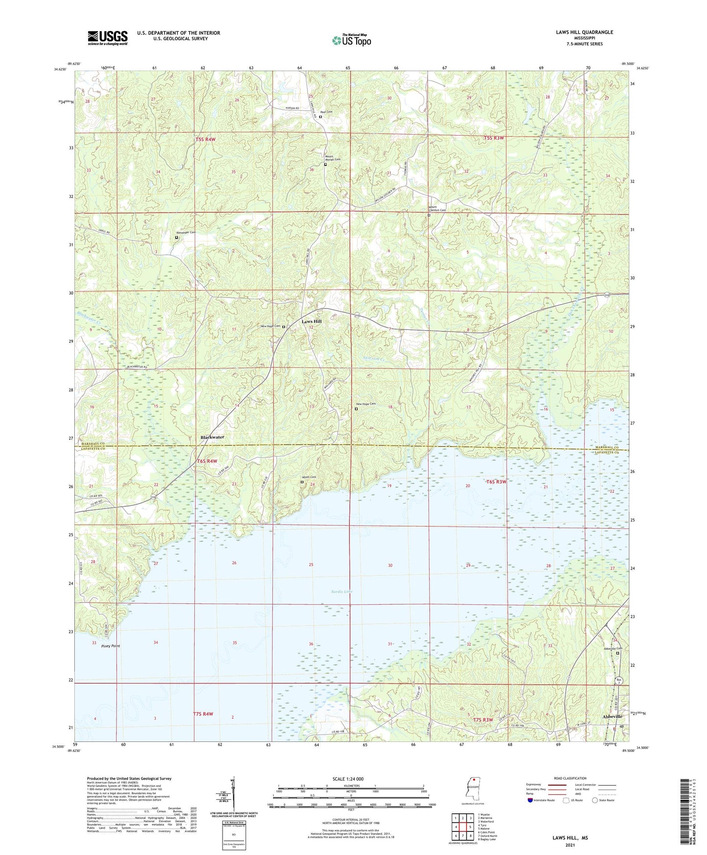
2021 topographic map quadrangle Laws Hill in the state of Mississippi. Scale: 1:24000. Based on the newly updated USGS 7.5' US Topo map series, this map is in the following counties: Lafayette, Marshall. The map contains contour data, water features, and other items you are used to seeing on USGS maps, but also has updated roads and other features. This is the next generation of topographic maps. Printed on high-quality waterproof paper with UV fade-resistant inks.
Quads adjacent to this one:
West: Tyro
Northwest: Wyatte
North: Marianna
Northeast: Waterford
East: Malone
Southeast: Bagley Lake
South: Oxford North
Southwest: Coles Point
Contains the following named places: Abbeville, Abbeville Cemetery, Abbeville Post Office, Abbeville School, Alexander Cemetery, Bible Way Church, Blackwater, Blackwater Creek, Dunnovants Ferry, Gallegley Store, Graham Lake, Harris Chapel, Laws Hill, Laws Hill School, Mount Comfort Cemetery, Mount Comfort Christian Methodist Episcopal Church, Mount Comfort School, Mount Maria Church, Mount Moriah Cemetery, Mount Moriah Church, Mount Vernon Church, Mount Vernon School, New Hope Cemetery, New Hope Church, Newsom Creek, Oak Chewalla Creek, Pauls Chapel, Peel Cemetery, Pigeon Roost Watershed Y-5-124 Dam, Piney Point, Redmans Bluff Public Use Area, Smith School, Smith Store, Town of Abbeville, Turner Creek, Wyatt, Wyatt Bridge, Wyatt Cemetery, Wyatt Crossing Public Use Area