MyTopo
Lucre Mississippi US Topo Map
Couldn't load pickup availability
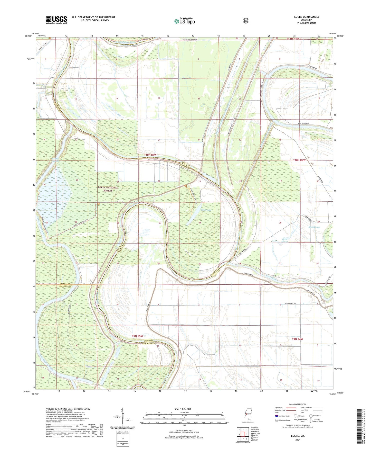
2021 topographic map quadrangle Lucre in the state of Mississippi. Scale: 1:24000. Based on the newly updated USGS 7.5' US Topo map series, this map is in the following counties: Yazoo, Sharkey, Issaquena. The map contains contour data, water features, and other items you are used to seeing on USGS maps, but also has updated roads and other features. This is the next generation of topographic maps. Printed on high-quality waterproof paper with UV fade-resistant inks.
Quads adjacent to this one:
West: Valley Park
Northwest: Red Rock
North: Holly Bluff
Northeast: Bayland SE
East: Satartia
Southeast: Phoenix
South: Eldorado
Southwest: Floweree
Contains the following named places: Belle Yazoo Plantation, Big Sunflower River, Black Bayou, Clark Lake, Cypress Bayou, Deep Slough, Ellwood Landing, Fairview Landing, Fairview Plantation, Harworth, Horn Place Landing, Kansas Landing, Lake George Drainage Ditch, Leats Landing, Little Sunflower Landing, Little Sunflower River, Lucre, Madisons Woodyard Landing, Miller Landing, Nelsons Place Landing, Pilgrim Rest Church, Pleasant Home Landing, Ryans L'Argent Landing, Shell Mound Landing, Six Mile Cut-Off, South Greentree Reservoir, Spanish Fort Landing, Trucks Woodyard Landing, Yazoo Backwater Levee, Yucatan Plantation