MyTopo
Marcella Mississippi US Topo Map
Couldn't load pickup availability
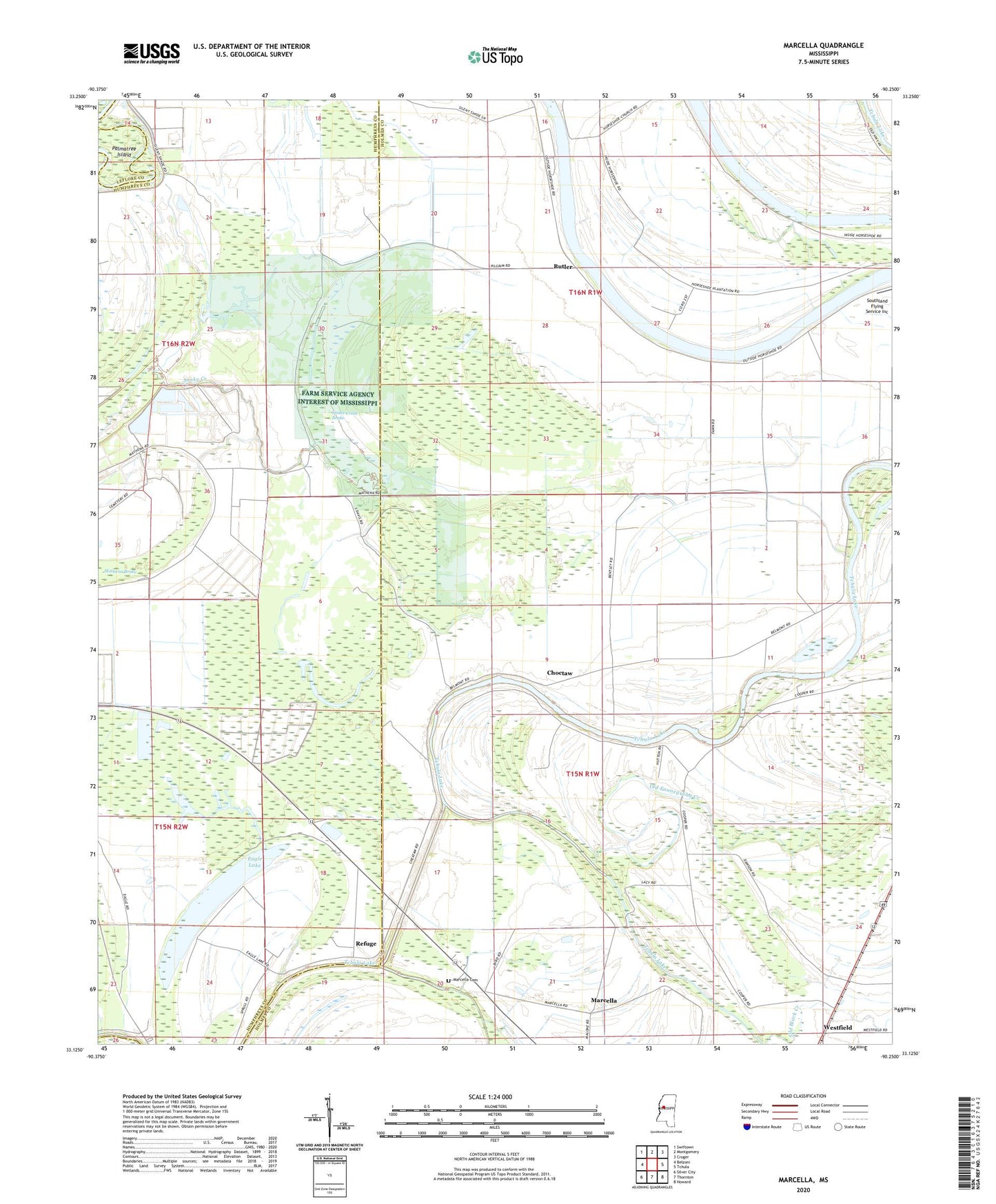
2020 topographic map quadrangle Marcella in the state of Mississippi. Scale: 1:24000. Based on the newly updated USGS 7.5' US Topo map series, this map is in the following counties: Holmes, Humphreys, Leflore. The map contains contour data, water features, and other items you are used to seeing on USGS maps, but also has updated roads and other features. This is the next generation of topographic maps. Printed on high-quality waterproof paper with UV fade-resistant inks.
Quads adjacent to this one:
West: Belzoni
Northwest: Swiftown
North: Montgomery
Northeast: Cruger
East: Tchula
Southeast: Howard
South: Thornton
Southwest: Silver City
Contains the following named places: Annie York Church, Belmont Landing, Blanch Chapel, Butler, Choctaw, Choctaw Landing, Dawson, Eagle Lake, Fannegusha Creek, Farm Service Agency Interest of Mississippi, Grassy Lake, Graves Landing, Holly Bank Landing, Hookers Woodyard Landing, Horseshoe Chapel, Horseshoe Church, Horseshoe Lake, Kiern and Jones Landing, Manchester Landing, Marcella, Marcella Cemetery, Marcella Church, Marcella Landing, Marcella Quarters Landing, Mathena Brake, Mount Everet Church, Mount Harmon Church, Mount Rosies Church, Mount Sinai Church, Old Fannegusha Creek, Palmatree Island, Pinkerton Lake Dam, Ray Ann Chapel School, Refuge, Snake Creek Brake, Tallequah Landing, Thornton Place Landing, Tomes Chapel, Watsons Landing, Westfield, Zion City Church