
MyTopo
McCool Mississippi US Topo Map
Couldn't load pickup availability
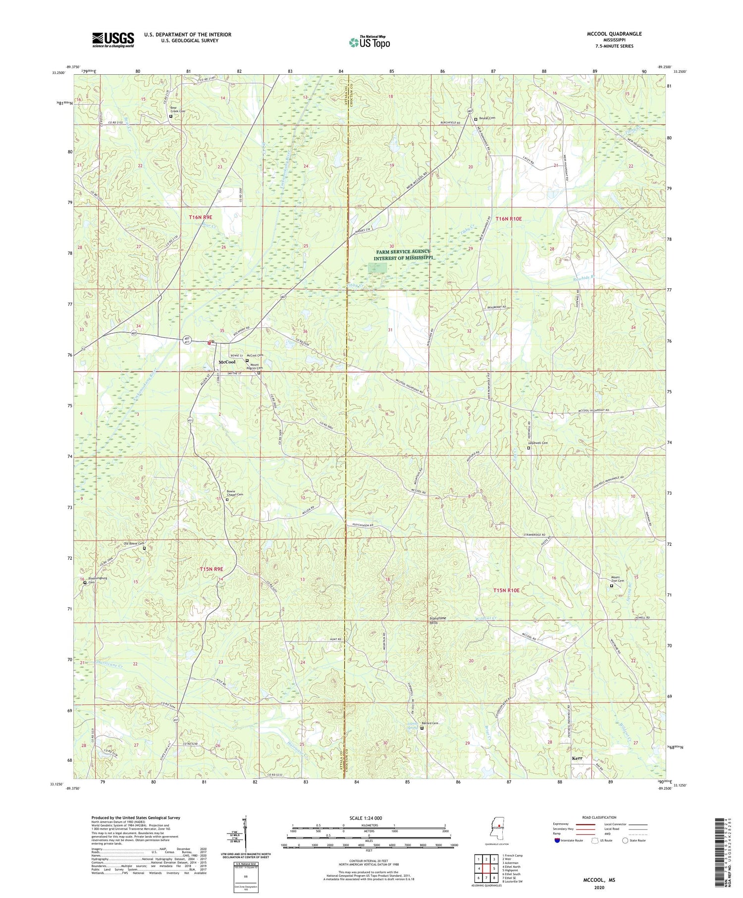
2020 topographic map quadrangle McCool in the state of Mississippi. Scale: 1:24000. Based on the newly updated USGS 7.5' US Topo map series, this map is in the following counties: Choctaw, Attala. The map contains contour data, water features, and other items you are used to seeing on USGS maps, but also has updated roads and other features. This is the next generation of topographic maps. Printed on high-quality waterproof paper with UV fade-resistant inks.
Quads adjacent to this one:
West: Ethel North
Northwest: French Camp
North: Weir
Northeast: Ackerman
East: Highpoint
Southeast: Louisville SW
South: Ethel SE
Southwest: Ethel South
Contains the following named places: Alex Faulkner Lake Dam, Allen Springs School, Antioch, Antioch Baptist Church, Ashfordville School, Ballard Cemetery, Bear Creek, Bear Creek Cemetery, Bear Creek Missionary Baptist Church, Bear Creek School, Beulah Baptist Church, Beulah Cemetery, Bloomingburg Cemetery, Bowie Chapel Cemetery, Bowie Chapel Methodist Church, Bowie School, Bowies Chapel, Church of God, Conly Mills, Dry Creek, Egg Creek, Hobson School, Hopewell Cemetery, Hopewell Church, Ironstone Hills, Kerr, Lignite Spring, McCool, McCool Cemetery, McCool Fire Department, McCool Post Office, Mount Pilgrim Cemetery, Mount Zion Cemetery, Mount Zion Church, Old Bowie Cemetery, Rawhide Branch, Simmons Lake Dam, Steele, Supervisor District 4, Tibby Creek, Town of McCool, Vowell School, ZIP Code: 39108


