MyTopo
Meadville Mississippi US Topo Map
Couldn't load pickup availability
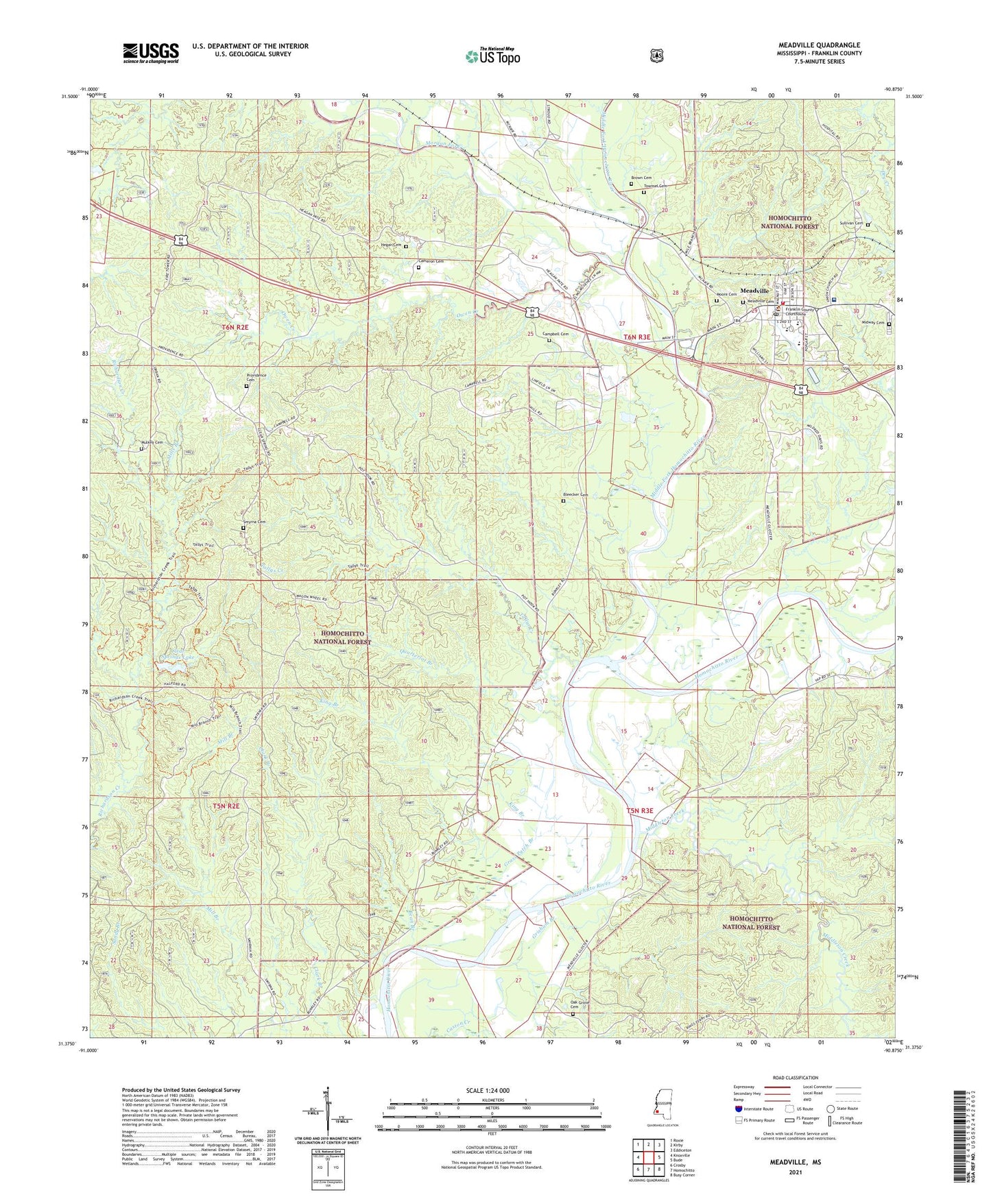
2021 topographic map quadrangle Meadville in the state of Mississippi. Scale: 1:24000. Based on the newly updated USGS 7.5' US Topo map series, this map is in the following counties: Franklin. The map contains contour data, water features, and other items you are used to seeing on USGS maps, but also has updated roads and other features. This is the next generation of topographic maps. Printed on high-quality waterproof paper with UV fade-resistant inks.
Quads adjacent to this one:
West: Knoxville
Northwest: Roxie
North: Kirby
Northeast: Eddiceton
East: Bude
Southeast: Busy Corner
South: Homochitto
Southwest: Crosby
Contains the following named places: Bean Branch, Bleecker Cemetery, Brown Cemetery, Bunkley Oil Field, Butler, Cameron Cemetery, Campbell Cemetery, Clear Springs Dam, Clear Springs Lake, Clear Springs Recreation Area, Frankin County Courthouse, Frankin Elementary School, Franklin County, Franklin County Memorial Hospital, Franklin County Sheriff's Office, Franklin High School, Franklin Lookout Tower, Galverth Lake Dam, Grass Patch Branch, Grisham Branch, Hegan Cemetery, Homochitto National Forest, King Branch, Kirby Oil Field, Meadville, Meadville Cemetery, Meadville Police Department, Meadville Post Office, Meadville Volunteer Fire Department, Middle Fork Homochitto River, Middleton Creek, Midway Cemetery, Mills Branch, Moore Cemetery, Morgan Fork, Mount Pleasant Church, Mount Zinia Church, Mulkey Cemetery, New Fork Church, Oak Grove Cemetery, Owen Creek, Pine Ridge Church, Providence Baptist Church, Providence Cemetery, Providence Oil Field, Quarterlot Branch, Smyrna Cemetery, South Providence Oil Field, Suffolk, Sullivan Cemetery, Supervisor District 3, Tallys Creek, Tallys Creek Oil Field, Town of Meadville, Townsel Cemetery, Whitington Roadside Park