MyTopo
Meehan Mississippi US Topo Map
Couldn't load pickup availability
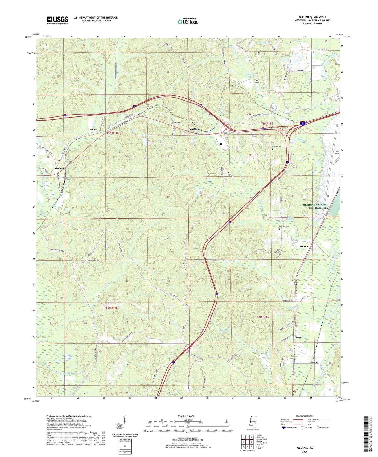
2020 topographic map quadrangle Meehan in the state of Mississippi. Scale: 1:24000. Based on the newly updated USGS 7.5' US Topo map series, this map is in the following counties: Lauderdale. The map contains contour data, water features, and other items you are used to seeing on USGS maps, but also has updated roads and other features. This is the next generation of topographic maps. Printed on high-quality waterproof paper with UV fade-resistant inks.
Quads adjacent to this one:
West: Chunky
Northwest: Duffee
North: Collinsville
Northeast: Meridian North
East: Meridian South
Southeast: Sable
South: Stonewall
Southwest: Rose Hill
Contains the following named places: Allen Creek, Arunde, Arundel Spring, Burwell Cemetery, Burwell Creek, Burwell Lake, Burwell Lake Dam, Cow Creek, Doctor Slaughter Lake Dam, DuBose School, East Mississippi Correctional Facility, Fairchild Cemetery, Fairchild Springs, Golden Grove Church, Goodwater Baptist Church, Goodwater Cemetery, Graham, Hognose Creek, Little Creek, Lost Gap, Lost Gap Church, Lost Gap Volunteer Fire and Rescue Department, Meehan, Meehan Volunteer Fire and Rescue Department, Meridian National Fish Hatchery, Mount Zion Church, National Fish Hatchery Ponds Dam, New Prospect Baptist Church, O'Neil Lake, Osborne Cemetery, P Coleman Pond Dam, Pigford Lake, Pigford Lake Dam, Pleasant Grove Church, Poplar Spring Church, R Johnson Lake Dam, Rock Creek, Sageville Cemetery, Sageville Church, Savoy, Sowashee Creek, Sterling, Tillman Lookout Tower, Tunnel Hill, Tunnel Hill Cemetery, Ullyses Lee Pond Dam, Usher Lake, ZIP Code: 39307