MyTopo
Money Mississippi US Topo Map
Couldn't load pickup availability
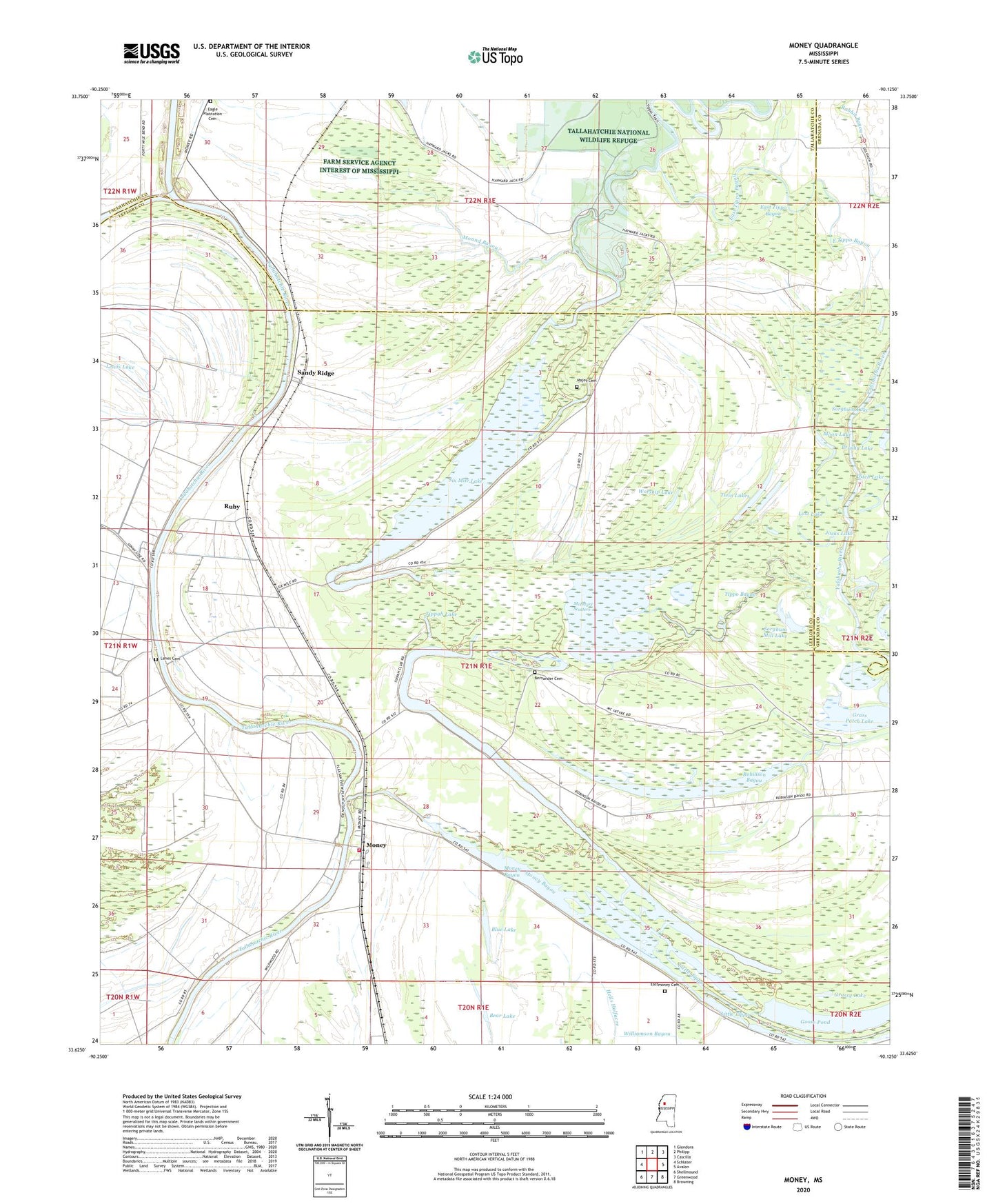
2020 topographic map quadrangle Money in the state of Mississippi. Scale: 1:24000. Based on the newly updated USGS 7.5' US Topo map series, this map is in the following counties: Leflore, Tallahatchie, Grenada, Carroll. The map contains contour data, water features, and other items you are used to seeing on USGS maps, but also has updated roads and other features. This is the next generation of topographic maps. Printed on high-quality waterproof paper with UV fade-resistant inks.
Quads adjacent to this one:
West: Schlater
Northwest: Glendora
North: Philipp
Northeast: Cascilla
East: Avalon
Southeast: Browning
South: Greenwood
Southwest: Shellmound
Contains the following named places: Archula Landing, Bear Lake, Bernander Cemetery, Beulah Landing, Blue Lake, Brushy Lake, Church of God, Ditch Lake, Dry Bayou Landing, Eagle Plantation Cemetery, East Money Church, East Tippo Bayou, Eastmoney Cemetery, Ed Bledsoe Lake Dam, Elim Lake, Emerald, Evergreen Church, Ewings Landing, Float Road Bayou, Goose Pond, Grass Patch Lake, Grassy Lake, Green Chapel, Hayward Chapel, Hazard Landing, Horseshoe Lake, Jacks Lake, Landers Landing Public Access, Lanes Cemetery, Lanes Chapel, Lewis Lake, Little Tippo, Loch Lamond Landing, Lockloma Church, Lost Lake, Majet Cemetery, McIntyre Lake, McIntyre Scatters, Melrose Landing, Money, Money Bayou, Money Landing, Money Volunteer Fire Department, Moon Lake, Mound Bayou, New Hope Landing, Omega Landing, Peebles Landing, Powell Landing, Riverside Baptist Church, Robinson Bayou, Ruby, Ruby Landing, Sandy Ridge, Sandy Ridge Landing, Six Mile Lake, Sorghum Lake, Sorghum Mill Lake, Stancils Landing, Tippah Lake, Tippo Bayou, Trout Lake, Twin Lakes, Woodstock Landing, Worship Lake, Yuba Dam Landing, ZIP Code: 38950