
MyTopo
Murdock Lake Mississippi US Topo Map
Couldn't load pickup availability
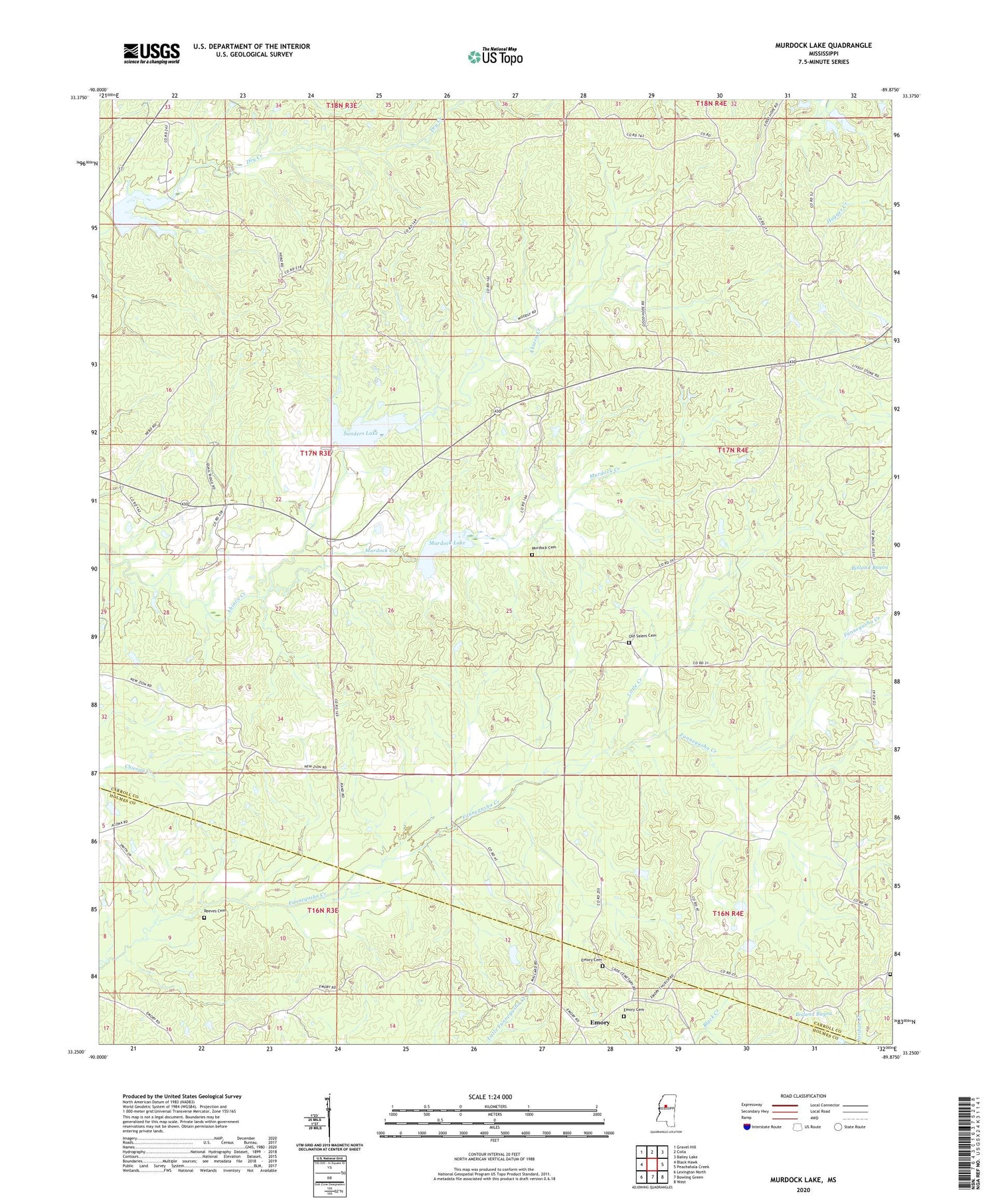
2020 topographic map quadrangle Murdock Lake in the state of Mississippi. Scale: 1:24000. Based on the newly updated USGS 7.5' US Topo map series, this map is in the following counties: Carroll, Holmes. The map contains contour data, water features, and other items you are used to seeing on USGS maps, but also has updated roads and other features. This is the next generation of topographic maps. Printed on high-quality waterproof paper with UV fade-resistant inks.
Quads adjacent to this one:
West: Black Hawk
Northwest: Gravel Hill
North: Coila
Northeast: Bailey Lake
East: Peachahala Creek
Southeast: West
South: Bowling Green
Southwest: Lexington North
Contains the following named places: Abiaca Watershed Y-34-8, Abiaca Watershed Y-34-9 Dam, Beards Lake, Bennet Church, Blackman Church, Blackmonton, Chun Corner, Emory, Emory Cemetery, Emory Church, Goodhope Church, Jeff Chapel, Little Creek, Martin Grove Cemetery, Martin Grove Church, Murdock Cemetery, Murdock Creek, Murdock Lake, Nebo Church, New Zion Church, Old Salem Cemetery, Reeves Cemetery, Sanders Lake, Shiloh Church


