MyTopo
Nicholson Mississippi US Topo Map
Couldn't load pickup availability
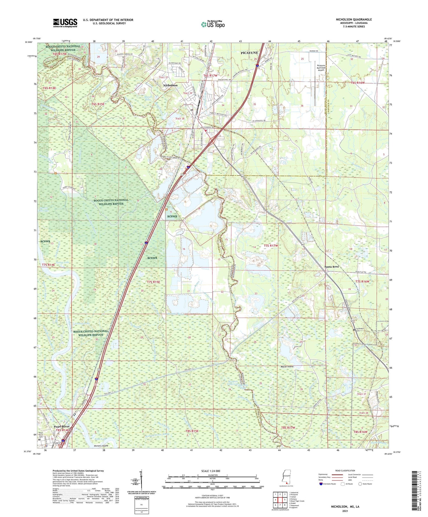
2021 topographic map quadrangle Nicholson in the states of Mississippi, Louisiana. Scale: 1:24000. Based on the newly updated USGS 7.5' US Topo map series, this map is in the following counties: Hancock, St. Tammany, Pearl River. The map contains contour data, water features, and other items you are used to seeing on USGS maps, but also has updated roads and other features. This is the next generation of topographic maps. Printed on high-quality waterproof paper with UV fade-resistant inks.
Quads adjacent to this one:
West: Hickory
Northwest: Industrial
North: Picayune
Northeast: Caesar
East: Dead Tiger Creek
Southeast: Logtown
South: Haaswood
Southwest: Slidell
Contains the following named places: Aaron Academy, Alligator Branch, Bilbo Lake, Bings Ferry, Black Bayou, Broadaxe Bayou, Cedar Grove Church, Clear Bayou, Corinth Church, Crooked Bayou, Current River, Dry Bayou, Emanuel Baptist Church, Gum Creek, Indian Bayou, Indian Camp Branch, Interstate 59 Welcome Center, Jackson Landing, Jackson Landing Road Church, Jesus Name Apostolic Church, Johns Bayou, Lindsey Lake, Little Indian Bayou, Macks Island, Magnolia Personal Care Home, McCall River, Middle Bayou, Mill Creek, Murdock Eddy Lake, Murdocks Eddy, Murphy Bayou, Nicholson, Nicholson Census Designated Place, Nicholson Elementary School, Nicholson First Baptist Church, Nicholson Post Office, Nicholson Volunteer Fire Department, Oak Ridge Church, Old Channel, Old Palestine Church, Old River, Oldfield Bayou, Open Swamp Bayou, Pearl Bayou, Pearl River, Pearl River Cemetery, Pearl River Municipal Sewage Treatment Plant, Pearl River Police Department, Pearl River State Wildlife Management Area, Picayune Municipal Airport, Proctor Plantation, Red Hill Church, Rones Bayou, Santa Rosa, Seaburn House Bayou, Second Alligator Branch, Starks Bayou, Stockstill Lake, Supervisor District 4, The Delta, Turkey Bayou, Turkey Lake, Turtleskin Cemetery, Turtleskin Creek, West Indian Bayou, Willow Bend Mobile Home Park, Yellow Bayou