MyTopo
Oak Ridge Mississippi US Topo Map
Couldn't load pickup availability
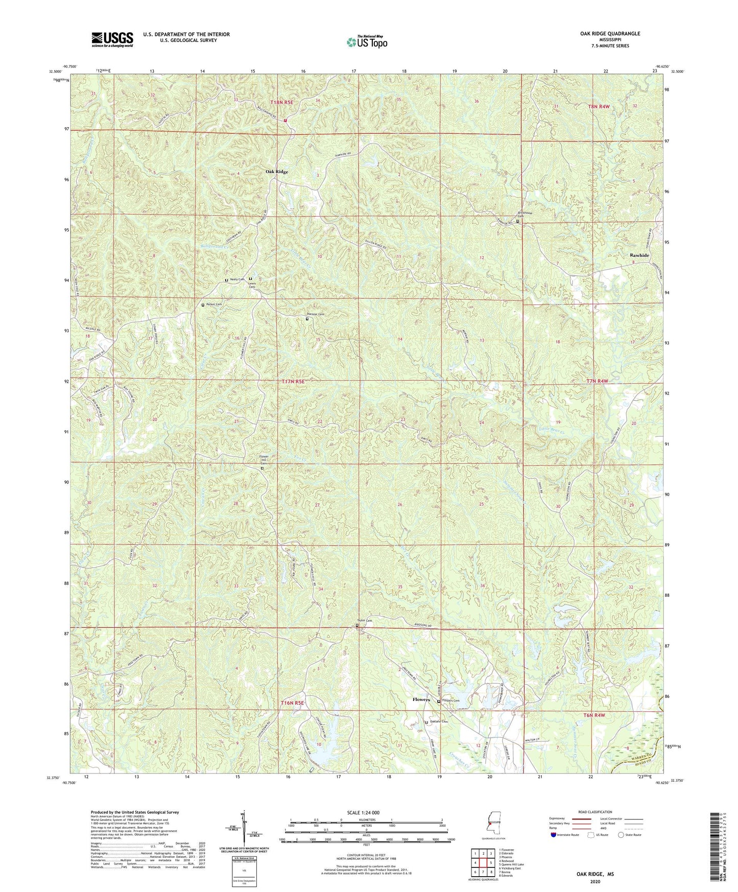
2020 topographic map quadrangle Oak Ridge in the state of Mississippi. Scale: 1:24000. Based on the newly updated USGS 7.5' US Topo map series, this map is in the following counties: Warren, Hinds. The map contains contour data, water features, and other items you are used to seeing on USGS maps, but also has updated roads and other features. This is the next generation of topographic maps. Printed on high-quality waterproof paper with UV fade-resistant inks.
Quads adjacent to this one:
West: Redwood
Northwest: Floweree
North: Eldorado
Northeast: Phoenix
East: Queens Hill Lake
Southeast: Edwards
South: Bovina
Southwest: Vicksburg East
Contains the following named places: Bear Creek School, Bethlehem Church, Bethlehem School, Bluff Experimental Forest, Brickhouse Cemetery, Brickhouse School, China Grove Church, Clear Creek School, Cowan Creek, Dornbusch Lake Dam, Flower Hill Cemetery, Flower Hill Church, Flowers, Flowers Cemetery, Fox Creek, Hackler Cemetery, Holy Hill Church, Holy Hill School, Jones Chapel, Lewis Cemetery, Little Bear Creek, Marley School, Neely Cemetery, Northeast Warren County Volunteer Fire Department, Oak Ridge, Oak Ridge Lookout Tower, Oak Ridge School, Oakland Cemetery, Oakland Church, Oren Bailess Lake Dam, Parker Cemetery, Rawhide, Ridgeway Church, Supervisor District 1, Taylor Cemetery