MyTopo
Red Rock Mississippi US Topo Map
Couldn't load pickup availability
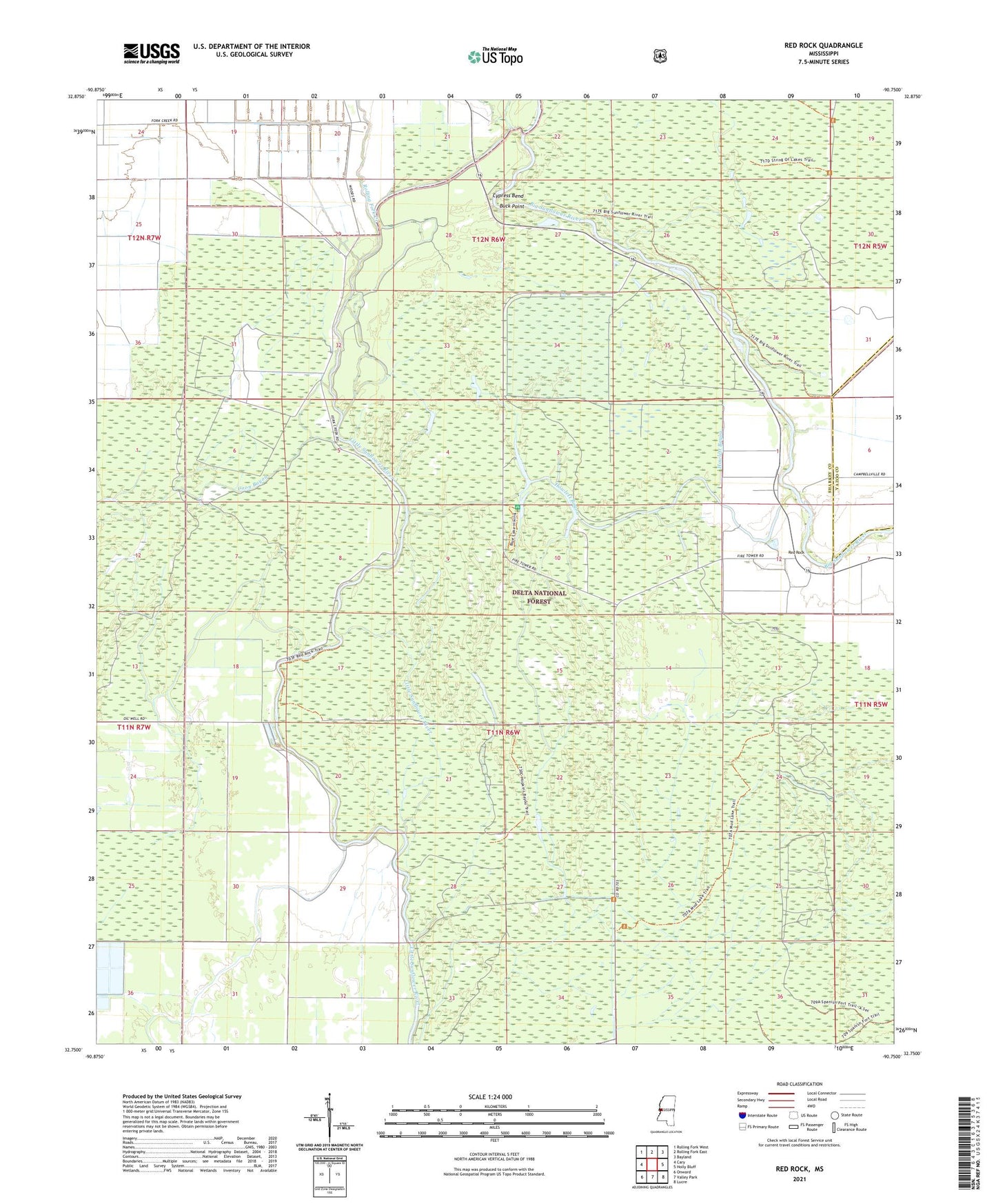
2021 topographic map quadrangle Red Rock in the state of Mississippi. Scale: 1:24000. Based on the newly updated USGS 7.5' US Topo map series, this map is in the following counties: Sharkey, Yazoo. The map contains contour data, water features, and other items you are used to seeing on USGS maps, but also has updated roads and other features. This is the next generation of topographic maps. Printed on high-quality waterproof paper with UV fade-resistant inks.
Quads adjacent to this one:
West: Cary
Northwest: Rolling Fork West
North: Rolling Fork East
Northeast: Bayland
East: Holly Bluff
Southeast: Lucre
South: Valley Park
Southwest: Onward
Contains the following named places: Barge Lake Campground, Blue Lake Picnic Area, Blue Lake Recreation Area, Buck Point, Choctaw Bayou, Choctaw Landing, Cypress Bend, Fish Lake, Howlett Bayou, Long Bayou-Greentree Reservoir, Lost Lake, Red Rock, Rolling Fork Creek, Rolling Fork Landing, Sunflower Waterfowl Project, Sunflower-Greentree Reservoir, Supervisor District 1