MyTopo
Rock Hill Mississippi US Topo Map
Couldn't load pickup availability
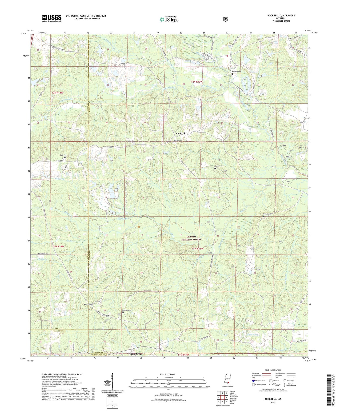
2021 topographic map quadrangle Rock Hill in the state of Mississippi. Scale: 1:24000. Based on the newly updated USGS 7.5' US Topo map series, this map is in the following counties: Forrest, Lamar, Pearl River. The map contains contour data, water features, and other items you are used to seeing on USGS maps, but also has updated roads and other features. This is the next generation of topographic maps. Printed on high-quality waterproof paper with UV fade-resistant inks.
Quads adjacent to this one:
West: Lumberton
Northwest: Purvis
North: Dixie
Northeast: McLaurin
East: Brooklyn
Southeast: Bond
South: Carnes
Southwest: Hillsdale
Contains the following named places: Anderson Cemetery, Attix Lake Dam, Battson Cemetery, Big Creek, Big Creek Landing Recreation Area, Bridge Creek, Bunk Branch, Cameron Cemetery, Cameron Creek, Camp Dantzler, Charles Branch, Circle One Airstrip, Clear Branch Church, Dearman Church, Elder Ridge Church, Forrest County Home, Komp Lake Dam, Laura Leake Lake Dam, Little Beaver Creek, Little Black Creek, McLaurin Volunteer Fire Department Station 2, Mount Olive Church, Pistol Ridge, Potato Creek, Rock Hill, Rock Hill Cemetery, Rock Hill Church, Rock Hill Lookout Tower, Simmons Cemetery, Slade Cemetery, Slade Church, Sleeper Creek, Supervisor District 5, Tracy, Truman Roberts Lake Dam, Tyner School