MyTopo
Schlater Mississippi US Topo Map
Couldn't load pickup availability
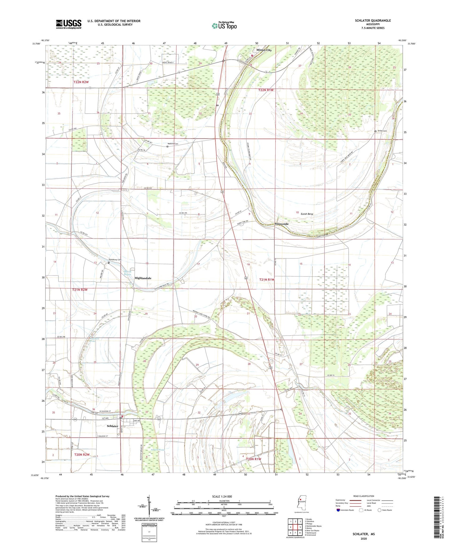
2020 topographic map quadrangle Schlater in the state of Mississippi. Scale: 1:24000. Based on the newly updated USGS 7.5' US Topo map series, this map is in the following counties: Leflore, Tallahatchie. The map contains contour data, water features, and other items you are used to seeing on USGS maps, but also has updated roads and other features. This is the next generation of topographic maps. Printed on high-quality waterproof paper with UV fade-resistant inks.
Quads adjacent to this one:
West: Rattlesnake Bayou
Northwest: Brooks
North: Glendora
Northeast: Philipp
East: Money
Southeast: Greenwood
South: Shellmound
Southwest: Bear Gut Bayou
Contains the following named places: Ashland Brake, Beverly Landing, Beverly Place Plantation, Brown Chapel, Buckhorn Brake, Eutah Bend, Eutaw Bend Landing, First Baptist Church, Highlandale, Holly Grove Landing, Humphrey Cemetery, Hydro, James Minter Ferry, Marsh Bayou, Marsh Berea Church, Marsh Prairie Landing, McNutt, McNutt Lake, Mile Tabernacle, Minter City Fire Department, Minter City Landing, Minter City Post Office, Moore Lake, Mount Olive Church, Mount Zion Church, Nebo Church, New Hope Chapel, New Hope Church, Palo Alto Church, Red Cross Landing, Rixes, Rosenwald School, Sanctified Church, Schlater, Schlater Baptist Church, Schlater Consolidated School, Schlater Post Office, Schlater Volunteer Fire Department, Shannondale Landing, Shiloh Cemetery, Sunny Side Landing, Sunnyside, Sunnyside Chapel, Sunnyside Elementary School, Supervisor District 1, Thankful Church, Town of Schlater, Turo, Walnut Grove Church, Watkins Cemetery, Woodland Church, Zion Watch Church, ZIP Code: 38952