MyTopo
Senatobia Mississippi US Topo Map
Couldn't load pickup availability
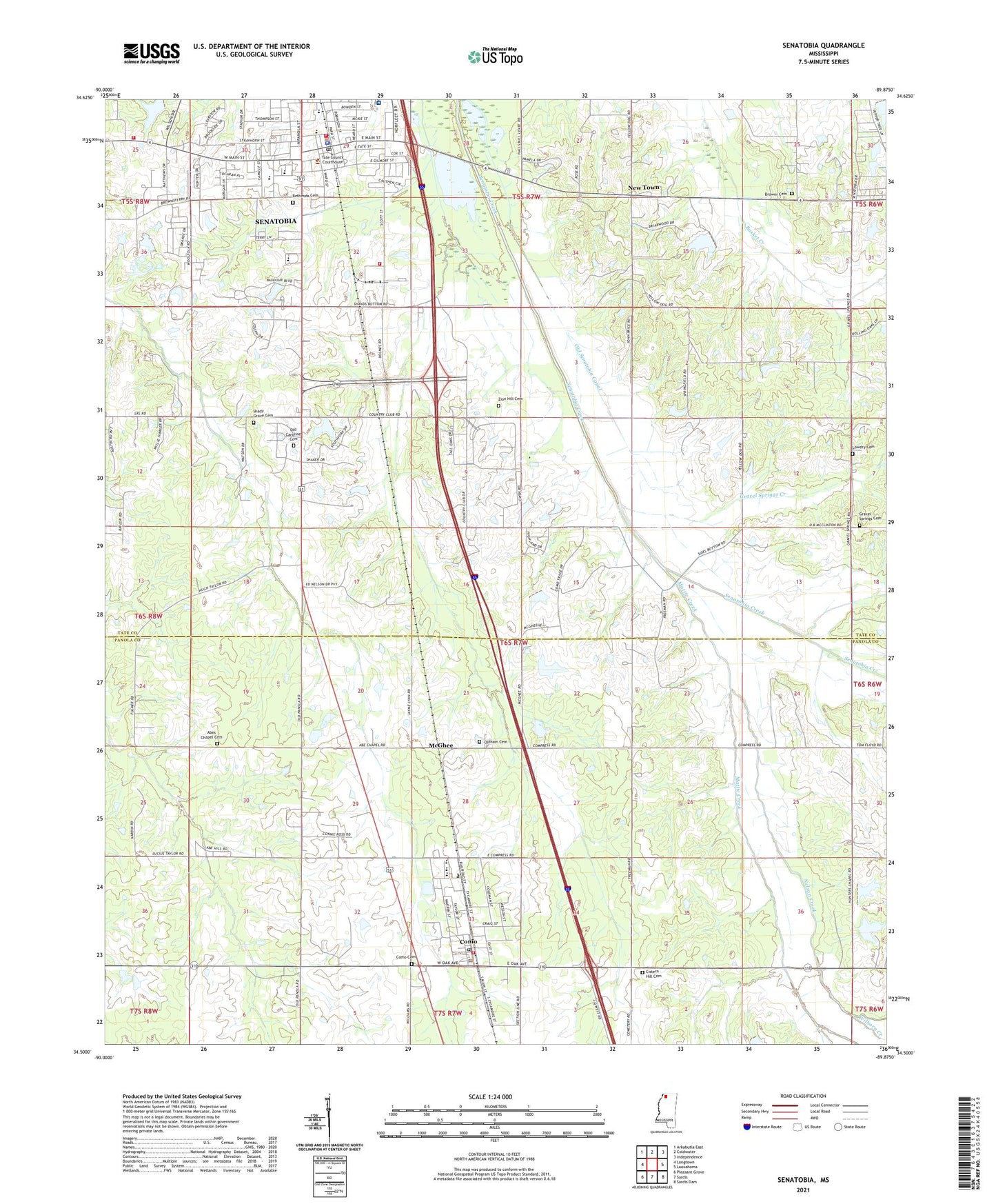
2021 topographic map quadrangle Senatobia in the state of Mississippi. Scale: 1:24000. Based on the newly updated USGS 7.5' US Topo map series, this map is in the following counties: Panola, Tate. The map contains contour data, water features, and other items you are used to seeing on USGS maps, but also has updated roads and other features. This is the next generation of topographic maps. Printed on high-quality waterproof paper with UV fade-resistant inks.
Quads adjacent to this one:
West: Longtown
Northwest: Arkabutla East
North: Coldwater
Northeast: Independence
East: Looxahoma
Southeast: Sardis Dam
South: Sardis
Southwest: Pleasant Grove
Contains the following named places: Abes Chapel, Abes Chapel Cemetery, Back Acres Country Club, Bethel Church, Bethesda Cemetery, Bethesda Presbyterian Church, Brower Cemetery, Church of Christ, Cistern Hill Cemetery, Cistern Hill Church, Cistern Hill School, City of Senatobia, Como, Como Cemetery, Como Church, Como City Fire Department, Como City Police Department, Como Elementary School, Como Post Office, Como School, East Side Shopping Center, Elmer Massey Pond Dam, First Baptist Church, First United Methodist Church, Gospel Temple Church of God in Christ, Gravel Springs, Gravel Springs Cemetery, Gravel Springs Church, Gravel Springs Creek, Highland Baptist Church, Holy Innocents Episcopal Church, Hunter Chapel, Hunters Chapel School, I C Keefer Pond Dam, Lowery Cemetery, Macedonia Church, Macedonia School, Magnolia Heights School, Mattic Creek, McGhee, Memorial Center, Miriam Orr Pond Dam, Nelson Creek, New Town, North Oak Regional Medical Center, North Panola Vocational Center, Old Caroline Cemetery, Old Senatobia Canal, Oldham Cemetery, Paul Baddour Pond Dam, Rosewall School, Saint Gregorys Catholic Church, Senatobia, Senatobia Christian Church, Senatobia Elementary School, Senatobia Fire Department Station 1, Senatobia Fire Department Station 2, Senatobia Fire Department Station 3, Senatobia High School, Senatobia Lakes, Senatobia Middle School, Senatobia Plaza Shopping Center, Senatobia Police Department, Senatobia Post Office, Senatobia Presbyterian Church, Shady Grove Cemetery, Shady Grove Church, Springfield Church, Tate County Courthouse, Tate County Sheriff's Office, Tolbert-Jones Creek, Town of Como, West Ditch, Wilborn Creek, Woolfolk Church, WSAO-AM (Senatobia), Zion Hill Cemetery, Zion Hill Church, Zion Hill School, ZIP Code: 38668