
MyTopo
Sidon Mississippi US Topo Map
Couldn't load pickup availability
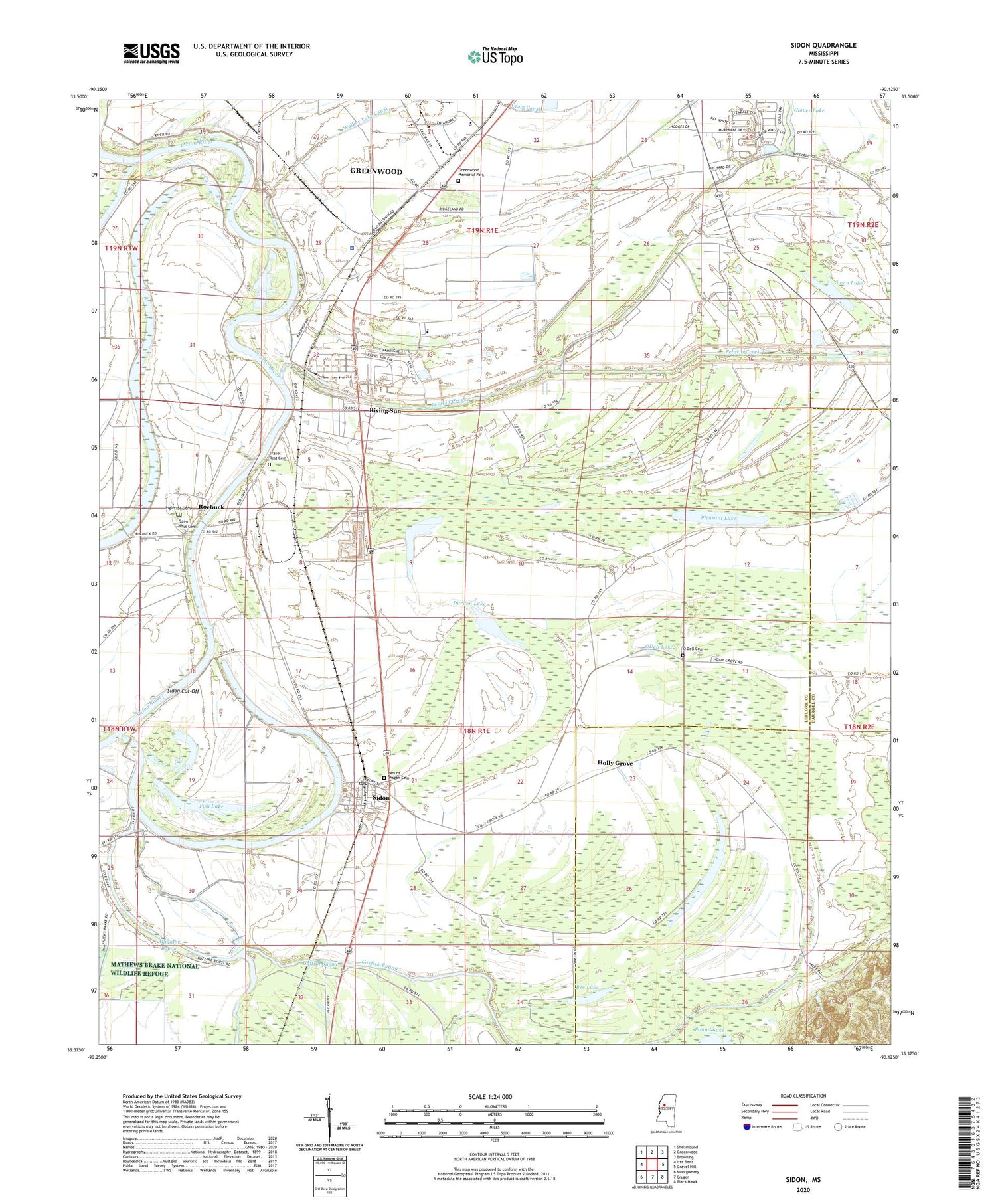
2020 topographic map quadrangle Sidon in the state of Mississippi. Scale: 1:24000. Based on the newly updated USGS 7.5' US Topo map series, this map is in the following counties: Leflore, Carroll. The map contains contour data, water features, and other items you are used to seeing on USGS maps, but also has updated roads and other features. This is the next generation of topographic maps. Printed on high-quality waterproof paper with UV fade-resistant inks.
Quads adjacent to this one:
West: Itta Bena
Northwest: Shellmound
North: Greenwood
Northeast: Browning
East: Gravel Hill
Southeast: Black Hawk
South: Cruger
Southwest: Montgomery
Contains the following named places: Beautiful Zion Church, Bee Lake, Catfish Bayou, Craig Canal, Douglass Landing, Durden Lake, Ellis School, Fish Lake, Fort Loring Landing, Grand View Landing, Greenwood Memorial Park, Holly Grove, Holly Grove Church, Ingelside Landing, Ingleside Cemetery, Jones Chapel, Leflore County Sheriff's Office, Leflore Landing Strip, Magenta Landing, Mount Pisgah Cemetery, Murdocks Ferry, New Chapel, O Dell Cemetery, O Dell Church, Oakwood Landing, ODell Lake, Palusha Creek Canal, Pelucia Creek, Pleasant Lake, Pleasant View Landing, Rising Sun, Rising Sun Elementary School, Rising Sun Landing, Robinsons Landing, Roebuck, Roebuck Landing, Rose Bower Landing, Round Lake, Saint John Church, Saint Paul Cemetery, Saint Paul Church, Second Lake, Sedgefield Landing, Sidon, Sidon Cut-Off, Sidon Cutoff Lake, Sidon Landing Number One, Sidon Landing Number Three, Sidon Landing Number Two, Sidon Post Office, Sidon Volunteer Fire Department, Swan Lake, Third Bridge Lake, Town of Sidon, Travel Rest Cemetery, Union Grove Church, Valley Farm Church, Walker Lake Canal, Walker Lake Pumping Plant, Water Front Landing, ZIP Code: 38954


