MyTopo
Tippo Mississippi US Topo Map
Couldn't load pickup availability
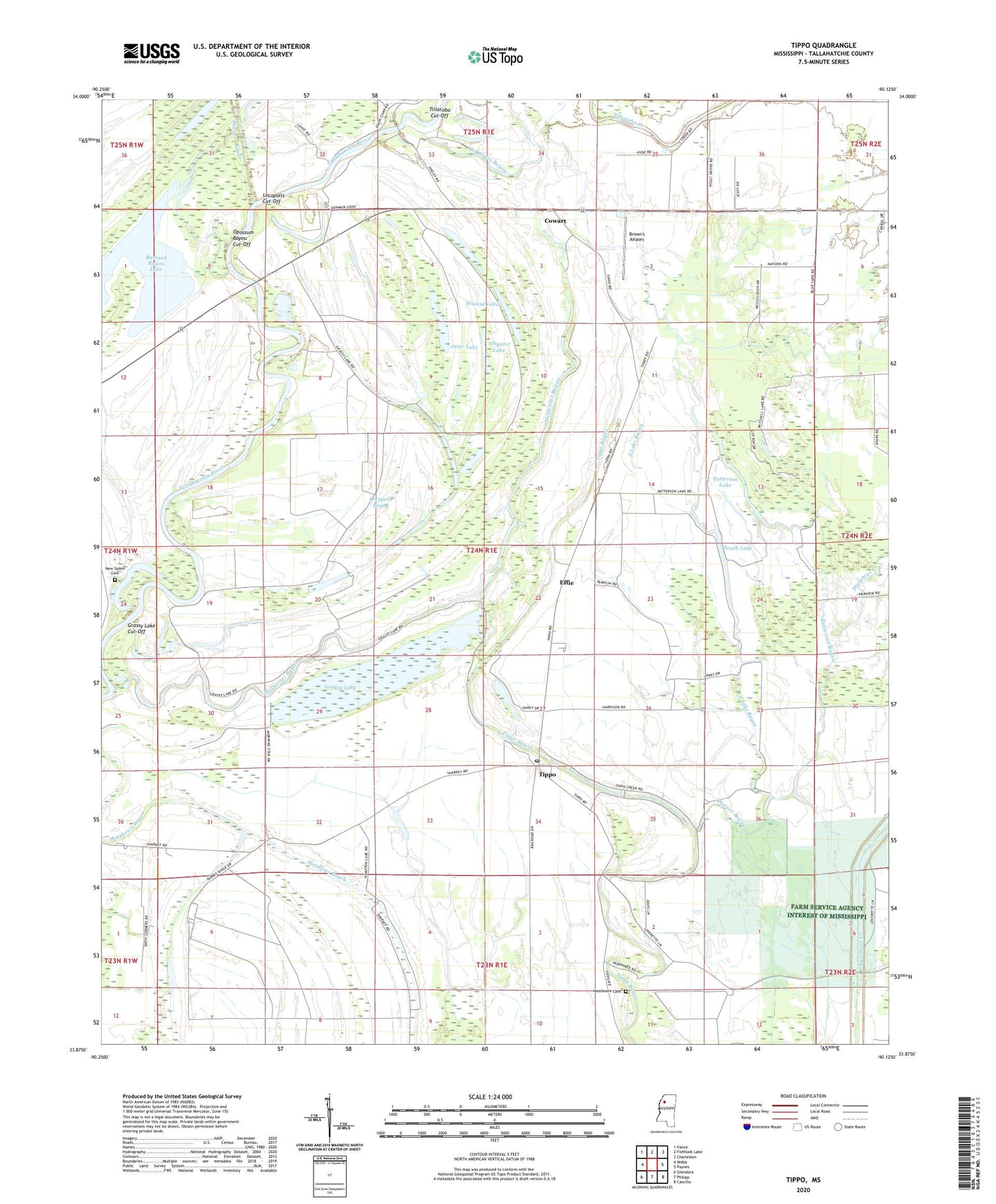
2020 topographic map quadrangle Tippo in the state of Mississippi. Scale: 1:24000. Based on the newly updated USGS 7.5' US Topo map series, this map is in the following counties: Tallahatchie. The map contains contour data, water features, and other items you are used to seeing on USGS maps, but also has updated roads and other features. This is the next generation of topographic maps. Printed on high-quality waterproof paper with UV fade-resistant inks.
Quads adjacent to this one:
West: Webb
Northwest: Vance
North: Fishhook Lake
Northeast: Charleston
East: Paynes
Southeast: Cascilla
South: Philipp
Southwest: Glendora
Contains the following named places: Alligator Lake, Bible Way Church, Brown's Airport, Buzzard Bayou, Cowart, Cowart Church, Effie, Grassy Lake, Grassy Lake Cut-Off, Holly Grove Church, Hubbard Creek, Jarman Ferry, Jarman Landing, Locopolis, Locopolis Bayou, Locopolis Church, Locopolis Cut-Off, Locopolis Landing, Mark Simmons Lake Dam, McQuirter Bayou, Morning Star Church, Murphree Creek, Murphy Brothers Lake Dam, Needmore, Needmore Cemetery, New Salem Cemetery, New Salem Church, Opossum Bayou Cut-Off, Otter Lake, Patterson Bayou, Patterson Lake, Pilgrim Rest Church, Platner Bayou, Rabbit Ridge Plantation, Saint Andrew Church, Saint Luke Church, South Lake, South Lake Bayou, Strider Academy, Strider-Taylor Public Access Area, Tallahatchie County, Tandy, Tillatoba Cut-Off, Tippo, Tippo Elementary School, Tippo Post Office, Walnut Lake, ZIP Code: 38921