MyTopo
Vicksburg East Mississippi US Topo Map
Couldn't load pickup availability
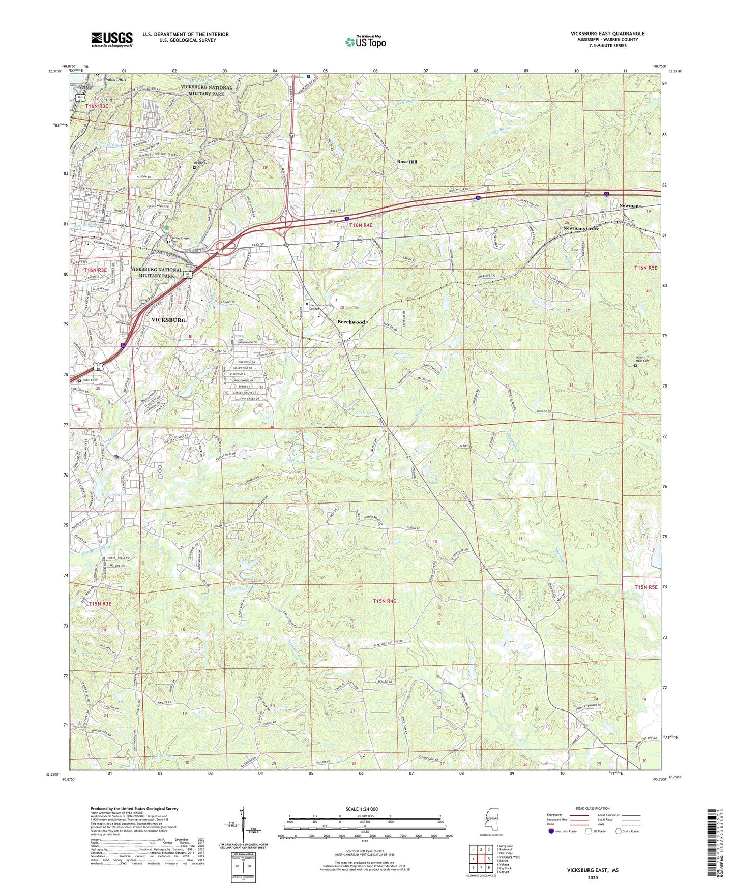
2020 topographic map quadrangle Vicksburg East in the state of Mississippi. Scale: 1:24000. Based on the newly updated USGS 7.5' US Topo map series, this map is in the following counties: Warren. The map contains contour data, water features, and other items you are used to seeing on USGS maps, but also has updated roads and other features. This is the next generation of topographic maps. Printed on high-quality waterproof paper with UV fade-resistant inks.
Quads adjacent to this one:
West: Vicksburg West
Northwest: Long Lake
North: Redwood
Northeast: Oak Ridge
East: Bovina
Southeast: Cayuga
South: Big Black
Southwest: Yokena
Contains the following named places: Anshe Chesed Cemetery, Battery De Golyer, Beechwood, Beechwood Census Designated Place, Bellemeade, Bernard Acres, Beulah Cemetery, Brabston Lake Dam, Brown Lake, Brown Lake Dam, Calvary Church, China Grove Church, Christian Home Church, Clover Valley Church, Culkin, Culkin Academy, Evan S Recreation Pond Dam, Evans Lake Dam, Farm Land Company Lake Dam, Fisher Ferry Volunteer Fire Department Substation, Fort Garrott, Fort Hill, Great Redoubt, Greenbriar, Grove Street Elementary School, Hall Lake Dam, Jackson Street Baptist Church, Jonestown, King Solomon Baptist Church, Kingdom Hall Church, Kuhn Hospital, Lake Park Dam, Lakewood, Latham Lake Dam, Leroy George Lake Dam, Locust Grove Church, Mercy Hospital, Mercy Seat Church, Merit Health River Region, Mint Spring Branch, Mount Alban Station, Mount Albin Cemetery, Mount Albin Church, Mount Arrat Church, Mount Zion Number 1 Baptist Church, New Zion Church, Newmans, Newmans Grove, Porters Chapel, Railroad Redoubt, Rosa Temple School, Rose Hill, Saint Aloysius High School, Saint Marys Catholic Church, Saint Marys Episcopal Church, Saint Pauls Church, Scott Lake, Scott Lake Dam, Second Texas Lunette, Shady Grove Church, Shiloh Creek, Shiloh Primitive Baptist Church, Southhaven, Stockade Redan, Strong Lake Dam, Supervisor District 3, Supervisor District 5, Swett Lake, Tates Cemetery, Third Louisiana Redan, Trinity Church, Two Mile Bridge, United States Waterways Experiment Station, Vicksburg Church of God in Christ, Vicksburg Country Club, Vicksburg Fire Department Station 2, Vicksburg Fire Department Station 8, Vicksburg National Cemetery, Vicksburg National Military Park, Warren Central School, Warren County, Warren County Farm, Waterways Experiment Station Dam, WJFL-AM (Vicksburg), WKYV-FM (Vicksburg), WQBC-AM (Vicksburg)