MyTopo
Anniston Missouri US Topo Map
Couldn't load pickup availability
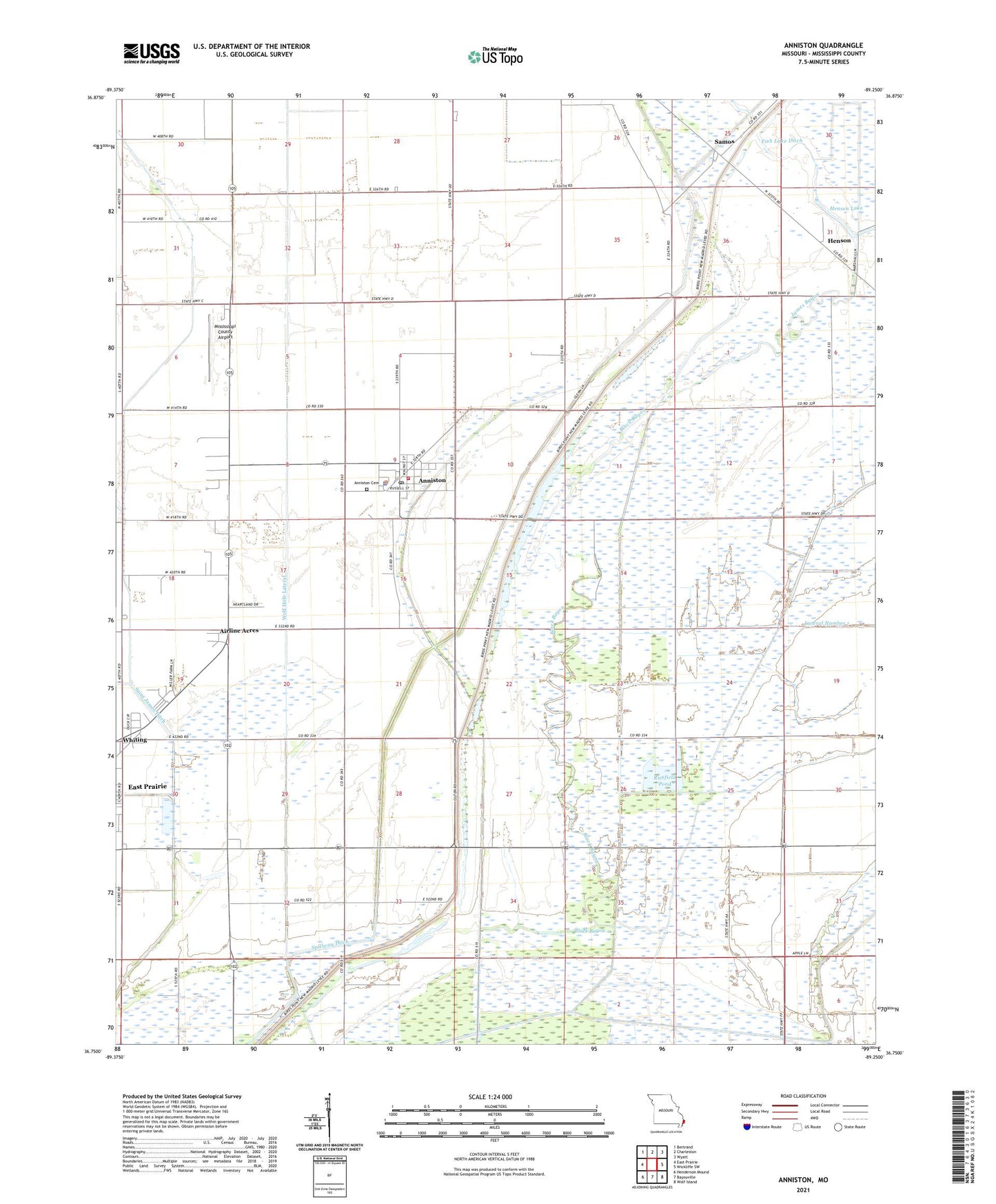
2021 topographic map quadrangle Anniston in the state of Missouri. Scale: 1:24000. Based on the newly updated USGS 7.5' US Topo map series, this map is in the following counties: Mississippi. The map contains contour data, water features, and other items you are used to seeing on USGS maps, but also has updated roads and other features. This is the next generation of topographic maps. Printed on high-quality waterproof paper with UV fade-resistant inks.
Quads adjacent to this one:
West: East Prairie
Northwest: Bertrand
North: Charleston
Northeast: Wyatt
East: Wickliffe SW
Southeast: Wolf Island
South: Bayouville
Southwest: Henderson Mound
Contains the following named places: Airline Acres, Anniston, Anniston Fire Department, Anniston Police Department, Anniston Post Office, Black Bayou, Calhoun Cemetery, Concord Church, Concord School, Fish Lake Ditch, Fox School, Gravel Ridge Church, Henson, Henson Lake, Henson School, Howletts, James Bayou, KYMO-AM (East Prairie), Mississippi County, Mississippi County Airport, New Bethel Church, Pulltight, Pulltight Church, Ricefield Pond, Ricefield Pond Dam, Saint James Ditch, Saint Pauls Church, Samos, Town of Anniston, Travel Rest School, Vater, Whiting, Whiting Census Designated Place, Wolf Hole Lateral, Woolridge School, ZIP Code: 63820