MyTopo
Brownbranch Missouri US Topo Map
Couldn't load pickup availability
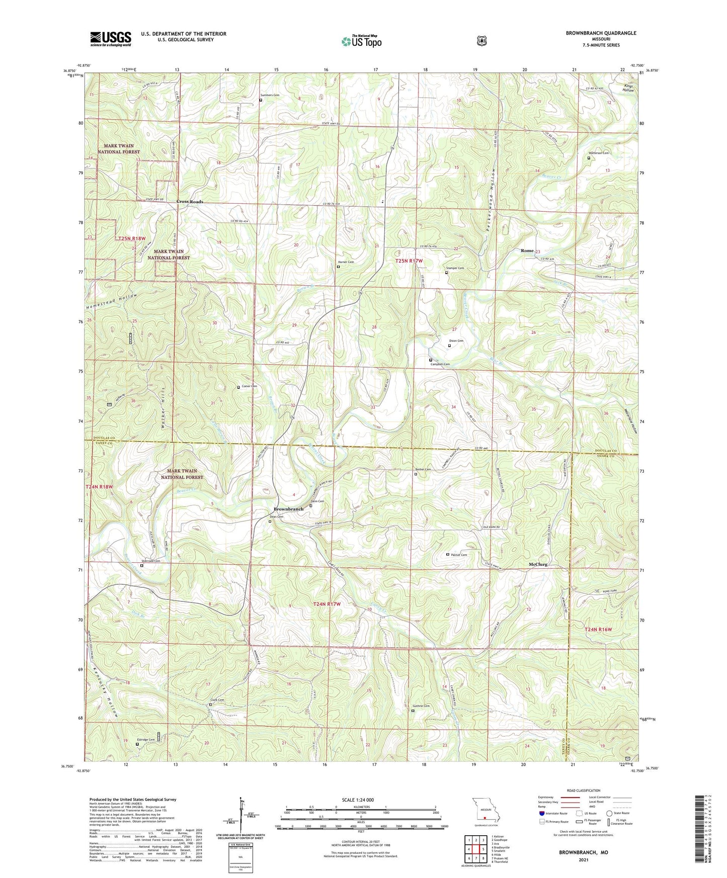
2021 topographic map quadrangle Brownbranch in the state of Missouri. Scale: 1:24000. Based on the newly updated USGS 7.5' US Topo map series, this map is in the following counties: Douglas, Taney, Ozark. The map contains contour data, water features, and other items you are used to seeing on USGS maps, but also has updated roads and other features. This is the next generation of topographic maps. Printed on high-quality waterproof paper with UV fade-resistant inks.
Quads adjacent to this one:
West: Bradleyville
Northwest: Keltner
North: Goodhope
Northeast: Ava
East: Smallett
Southeast: Thornfield
South: Protem NE
Southwest: Hilda
Contains the following named places: Barger School, Bear Branch, Bethel Cemetery, Bethel Church, Bethel School, Brown Branch, Brownbranch, Brownbranch School, Campbell Cemetery, Caney Creek, Clark Cemetery, Comer Cemetery, Cross Roads, Dann Cemetery, Dean Cemetery, Dixon Cemetery, Eldridge Cemetery, Guthrie Cemetery, Horner Cemetery, Jack Branch, Kentucky Hollow School, Kings Hollow, Little Brown Branch, Lone Star School, McClurg, Nancy, Oak Ridge School, Palmer Cemetery, Patterson School, Peckerwood Hollow, Plainview R-8 School, Redoak School, Rome, Sandy Church, Sherrodd Cemetery, Stamper Cemetery, Summers Cemetery, Township of Campbell, Union Grove Church, Walker Hills, Waterhole Hollow, Watterson Cemetery