MyTopo
Burtville Missouri US Topo Map
Couldn't load pickup availability
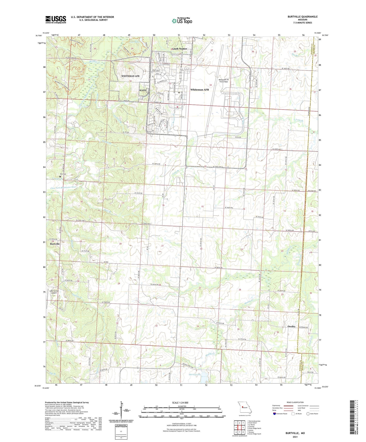
2021 topographic map quadrangle Burtville in the state of Missouri. Scale: 1:24000. Based on the newly updated USGS 7.5' US Topo map series, this map is in the following counties: Johnson, Pettis. The map contains contour data, water features, and other items you are used to seeing on USGS maps, but also has updated roads and other features. This is the next generation of topographic maps. Printed on high-quality waterproof paper with UV fade-resistant inks.
Quads adjacent to this one:
West: Cornelia
Northwest: Warrensburg East
North: Knob Noster
Northeast: La Monte
East: Green Ridge North
Southeast: Green Ridge South
South: Windsor
Southwest: Leeton
Contains the following named places: Adams Pond, Brewer Branch, Brushy School, Buck Branch, Burtville, Camp Bob White, Camp Red Cedar, Charles, Charles Post Office, Crooked Creek, Diamond Point School, Eldorado Church, Eldorado School, Ellis Cemetery, Fair Play School, Floridonia School, Graham Branch, Gribble Branch, Hall Lake Dam, Knob Noster State Park, Kranz Lake, Kranz Lake Dam, Lake Buteo, Lake Buteo Dam, Lake Sexton Airport, Mallard Pond, McAdoo Creek, Number 425 Dam, Oak Hill Church, Owsley, Pleasant Hill Church, Plum Branch, Prairie Home School, Roberts Hunter Lake Dam, Sexton Lake, Sexton Lake Dam, Shawnee Pond, Shirley Lake, Shirley Lake Dam, Township of Washington, Vinegar Branch, Whiteman Air Force Base, Whiteman Air Force Base Census Designated Place, Whiteman Air Force Base Elementary School, Whiteman Air Force Base Fire Emergency Services, Whiteman Air Force Base New Post Office, Woolery School, ZIP Code: 65305