MyTopo
Cedar Vista Missouri US Topo Map
Couldn't load pickup availability
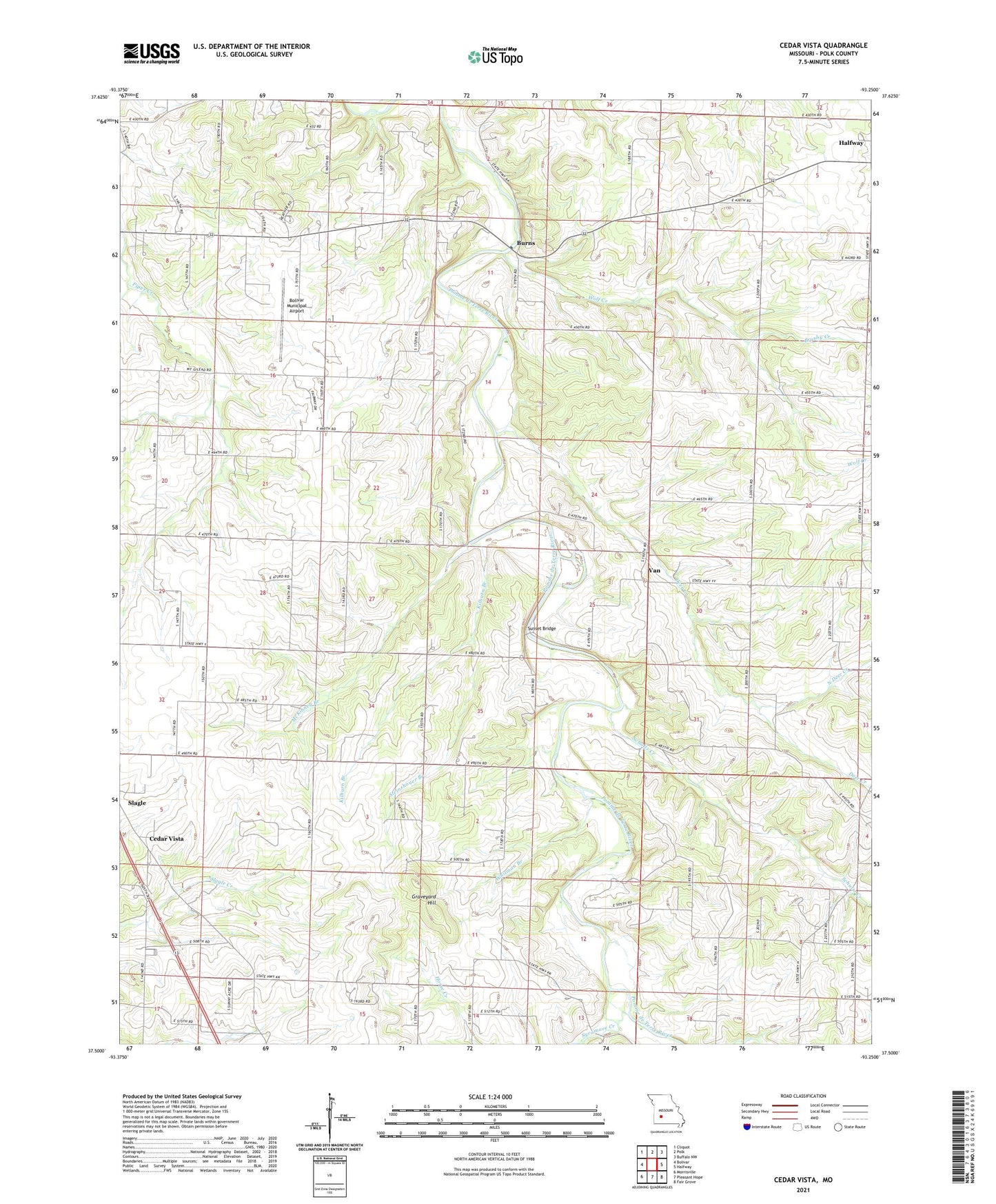
2021 topographic map quadrangle Cedar Vista in the state of Missouri. Scale: 1:24000. Based on the newly updated USGS 7.5' US Topo map series, this map is in the following counties: Polk. The map contains contour data, water features, and other items you are used to seeing on USGS maps, but also has updated roads and other features. This is the next generation of topographic maps. Printed on high-quality waterproof paper with UV fade-resistant inks.
Quads adjacent to this one:
West: Bolivar
Northwest: Cliquot
North: Polk
Northeast: Buffalo NW
East: Halfway
Southeast: Fair Grove
South: Pleasant Hope
Southwest: Morrisville
Contains the following named places: Bolivar Municipal Airport, Brushy Creek, Burns, Cedar Vista, Cherryvale School, Deer Creek, Graveyard Hill, Half Way Church, Hawk Lake Dam, Kilburn Branch, Leith School, McKinney Branch, McKinney School, Mount Gilead Church, New Bethel Church, New Bethel School, North Deer Creek, Owens Lake Section 8 Dam, Pleasant Hill Church, Providence Church, Providence School, Ralph Brooks Dam, Ratcliff School, Schultz Creek, Slagle Church, Slagle School, Steinshouer Branch, Sunset, Sunset Bridge, Sunset Church, Sunset School, Sycamore Creek, Township of Southeast Marion, Van, Van School, Wells School, Whitman Branch, Wilmington School, Wilson School, Wolf Creek, Woodmansey Ford