MyTopo
Clarence Cannon Dam Missouri US Topo Map
Couldn't load pickup availability
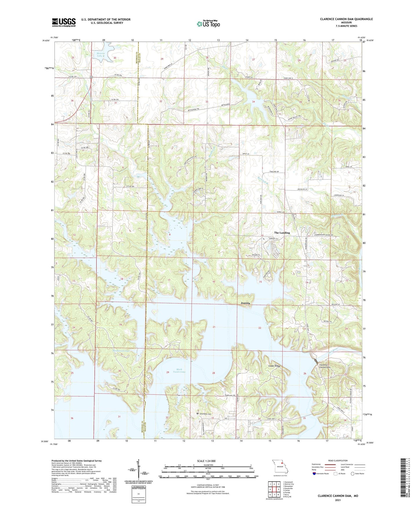
2021 topographic map quadrangle Clarence Cannon Dam in the state of Missouri. Scale: 1:24000. Based on the newly updated USGS 7.5' US Topo map series, this map is in the following counties: Ralls, Monroe. The map contains contour data, water features, and other items you are used to seeing on USGS maps, but also has updated roads and other features. This is the next generation of topographic maps. Printed on high-quality waterproof paper with UV fade-resistant inks.
Quads adjacent to this one:
West: Stoutsville
Northwest: Hunnewell
North: Monroe City
Northeast: Rensselaer
East: Center
Southeast: Perry NE
South: Perry
Southwest: Florida
Contains the following named places: Bethlehem Church, Black Hawk, Blackjack Marina, Cedar Ridge, Clarence Cannon Dam, Clear View, County Line Ford, Deer Run, DeMoss Church, Dry Fork, Eagle Point, Ely Branch, Flint Ridge, Fox, Frank Russell Recreation Area, Gentry School, Henderson Lake, Hereford School, Hickory Bluff Trail, Indian Creek, Indian Creek Marina, Indian Creek Recreation Area, Joanna, John F Spalding Recreation Area, Lick Creek Trail, Little Bluestem, Little Indian Creek, M W Boudreaux Recreation Area, Madden Branch, Madden School, Mark Twain Lake Management Office, Monroe City Dam, Monroe City Lake, Monroe City South Lake Dam, Monroe Lake B, Mount Hope Church, Mount Pleasant School, Mudd School, Night Hawk, Nolen School, Norton School, Oakland Church, Pleasant Grove Church, Ray Behrens Recreation Area, Rocklick School, Sandy Creek, Sentry Ridge, Shaver Ford, Shepard Ford, Spillway Recreation Area, The Landing, Thompson Lake Dam, Township of Saline, Utterback Cemetery, Yager School