MyTopo
Colony Missouri US Topo Map
Couldn't load pickup availability
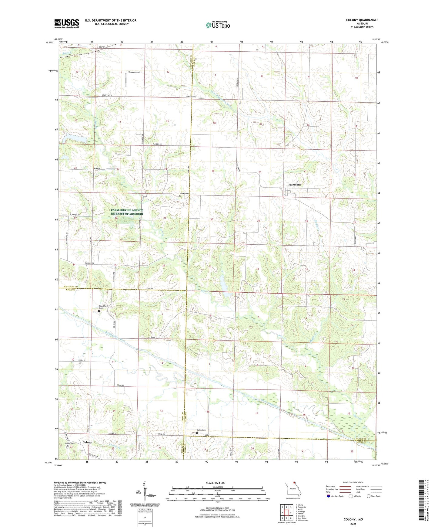
2021 topographic map quadrangle Colony in the state of Missouri. Scale: 1:24000. Based on the newly updated USGS 7.5' US Topo map series, this map is in the following counties: Clark, Scotland, Knox, Lewis. The map contains contour data, water features, and other items you are used to seeing on USGS maps, but also has updated roads and other features. This is the next generation of topographic maps. Printed on high-quality waterproof paper with UV fade-resistant inks.
Quads adjacent to this one:
West: Rutledge
Northwest: Arbela
North: Wyaconda
Northeast: Medill
East: Neeper
Southeast: Williamstown
South: Deer Ridge
Southwest: Knox City
Contains the following named places: Arkansas School, Bailey Cemetery, Bear Creek Church, Bear Creek Watershed Dam D-1, Bear Creek Watershed Dam D-2, Bear Creek Watershed Dam D-25, Bear Creek Watershed Structure F-1 Dam, Bear Creek Watershed Structure F-20 Dam, Clapp's Ford, Clark F-20 Lake, Colony, Colony Cemetery, D-25 Lake, Davis School, Fairmont, Fairmont Census Designated Place, Hines Airport, Narrow Grove School, Price School, Shaffer Creek, Standiford Cemetery, Sutter Cemetery, Tanyard School, Township of Washington, Vernon Branch, ZIP Code: 63474